The Oasis at Indio: Development & Approval Tracker
Track The Oasis at Indio’s proposed homes, industrial space, City Council decisions, traffic questions and construction milestones near Avenue 42 and Monroe Street.

The Oasis at Indio could reshape a large stretch of the Avenue 42–Monroe Street corridor. The proposal combines multifamily housing, commercial uses and substantial light-industrial development on approximately 183 acres north of Interstate 10.
This is a working development and approval tracker—not a launch announcement. Here you can compare the proposed buildout scenarios, understand the location, follow the public decisions and see which questions remain unanswered.
- Current status: Council voted unanimously to continue the project for further evaluation and revisions. The City Clerk’s minutes identify the motion and confirm that no approval or denial was taken.
- Previous April 2026 maximum scenario: up to 3,240 multifamily homes, 20,000 square feet of commercial space and approximately 1.806 million square feet of light industrial. These are earlier planning assumptions; a revised program has not been established by the sources checked.
- Why it matters: the proposal could affect North Indio’s housing supply, employment, freight activity and Avenue 42/Monroe travel.
- Photo baseline: original aerial photographs from September 9, 2026 now document the open site, adjoining roads and surrounding businesses.
Where the project stands
Council voted unanimously to continue the project
The City Clerk’s September 16 minutes in the October 7 agenda packet identify a motion by Mayor Pro Tem Waymond Fermon, seconded by Councilmember Oscar Ortiz, to continue the item to a future meeting for additional evaluation and revisions. The motion carried unanimously with all five councilmembers present. Council neither approved nor denied the project.
The minutes call for further review of traffic, environmental, fiscal and other impacts, including potential reductions to the proposed industrial/light-industrial uses. They do not specify a replacement industrial square footage. The developer’s website still displays the earlier approximately 1.806-million-square-foot program; no revised program or new hearing date was located in the sources checked October 19.
The April 2026 figures below remain a previous planning baseline, not an approved or confirmed final program. Original site photographs remain dated September 9, 2026.
This tracker separates what is proposed, what the public record supports and what still needs a decision. It will remain useful if the project is approved, revised, continued or denied. Project documents are not a substitute for the final ordinances, conditions, permits and recorded agreements.
On-site photo update: September 9, 2026
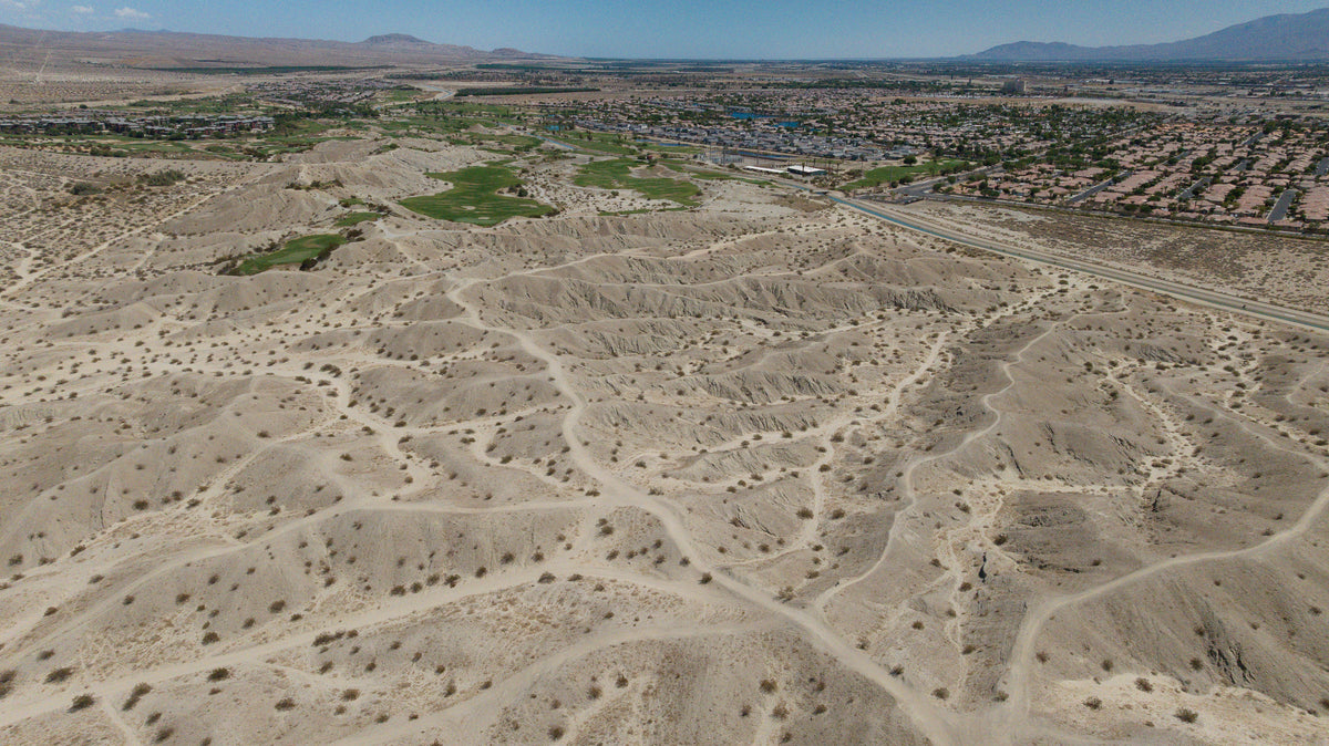
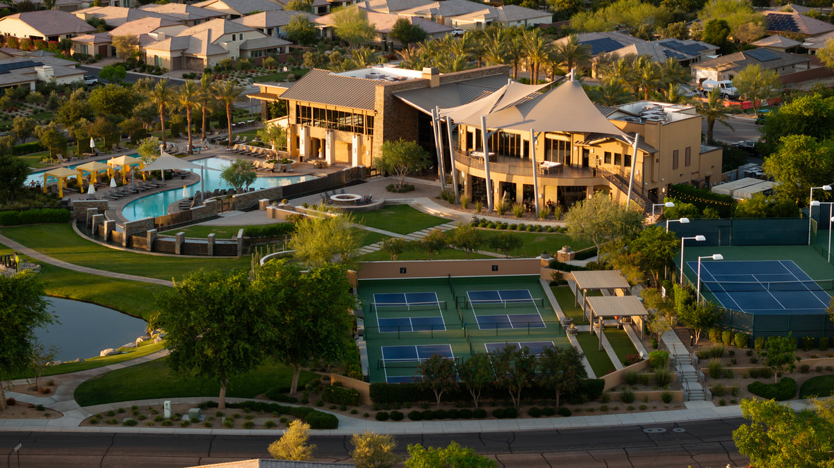
I visited the area on September 9 and photographed the site and its surroundings from the air. The views show broad areas of open land, sparse vegetation and surface tracks, alongside existing roads and nearby businesses. No vertical building construction is visible on the photographed open site. The photos establish a visual baseline; they do not verify a permitted construction start.
Click or tap any photo to view full screen. Use the arrows to browse all six images.


All photographs: Mark Miller / Desert Oasis Insider, September 9, 2026. Nearby shops and roads are shown for location context and are not presented as part of the proposed project.
Where is The Oasis at Indio?
The proposed site sits south of Avenue 42, west of Monroe Street and north of Interstate 10, with the Coachella Valley Stormwater Channel along its western side. It is particularly relevant to North Indio and the Avenue 42/Monroe corridor, including nearby Sun City Shadow Hills.
The land-use split matters: the plan identifies about 75.1 acres of mixed-use planning areas and 92.8 acres of light industrial. The remainder includes rights-of-way and a proposed 2.4-acre IID substation. This is not simply a 3,240-home neighborhood.
Two buildout scenarios in the planning documents
Reading these figures: use the April 2026 scenarios below as the baseline for comparing future revisions.
The environmental review examines a maximum housing scenario and a lower-housing scenario with more commercial space and a hotel. These are planning and analysis assumptions, not announced phases or guaranteed construction programs.
Maximum buildout: Up to 3,240 homes and 20,000 square feet of commercial space, alongside 1,806,290 square feet of light industrial.
| Component | Maximum buildout | Scenario 2 |
|---|---|---|
| Multifamily homes | Up to 3,240 | 1,237 |
| Commercial space | 20,000 sq. ft. | 71,600 sq. ft. |
| Hotel | None in this scenario | 128 rooms |
| Light-industrial space | 1,806,290 sq. ft. | 1,806,290 sq. ft. |
The important constant: reducing the housing count in Scenario 2 does not reduce the analyzed industrial square footage. The plan also does not allow unused residential or commercial capacity to become additional industrial square footage.
The developer describes a potential mix of apartments and townhomes, with rental and/or ownership possibilities. Specific builders, tenure, floor plans, HOA structures, pricing and sales dates are not established by those descriptions. The September economic materials also describe a proposed workforce-housing provision, summarized below; its adoption and final terms remain to be verified. Developer project overview.
Approval timeline and Council review
- June–August 2024
Draft environmental review
The Draft EIR circulated for public comment from June 25 through August 9, 2024. Agency and resident responses addressed the project’s environmental and neighborhood effects.
- April 2026
Final EIR and Specific Plan documents
The City’s document inventory includes the April 2026 Final EIR and Specific Plan. “Final EIR” identifies a document stage; it does not establish that the City Council has certified the EIR or approved the development.
- May 27, 2026
Planning Commission recommends denial
The commission voted 3–2 to recommend denial, according to meeting coverage. That recommendation is not a final City Council denial. The subsequent hearing notice expressly places the recommendations before the Council.
- August 27, 2026
City Council hearing notice published
The published notice identifies September 16 as the hearing date and describes proposed plan revisions, including industrial height, freeway setbacks and landscaping. Those revisions are proposals, not adopted protections.
- September 2026
Economic study and Council brief
The City’s project-document inventory includes a GPS Market Intel economic study and companion Council brief. The study discloses that BH Properties commissioned and funded it. These materials present a case for approval; they do not establish a Council decision.
- September 16–17, 2026 · Record checked October 19
Unanimous continuance for further review
Fermon moved and Ortiz seconded continuing the project to a future meeting for additional evaluation and revisions. All five councilmembers were present and the minutes record a unanimous vote. No final approval or denial was taken; potential reductions to industrial uses and further impact analysis remained for review.
Timeline sources: CEQAnet, City document inventory, May commission meeting coverage and published Council notice.
Even an affirmative Council decision would not mean every building is permitted or construction is imminent. The financial parcel map described in the notice does not itself create legal building sites. Later plans, conditions, infrastructure, permits and individual development reviews still matter.
September documents: proposed public benefits
The City hosts a 55-page economic study prepared by GPS Market Intel. BH Properties commissioned and funded the study. It argues for approval based on housing, employment and infrastructure benefits. Its estimates and conclusions are attributed to the report; publication on the City’s website does not establish adoption.
The companion Council brief describes these provisions:
- Monroe/I-10: a capped $3.5 million interchange contribution.
- Workforce housing: 5% of base-density units for households at 80–120% of area median income. That percentage should not automatically be applied to the maximum 3,240-home figure.
- Parkland: an approximately three-acre park, credited against the park-fee obligation.
- Electrical infrastructure: about 2.4 acres reserved for an IID substation. The brief does not establish that BH Properties would fund its construction.
What still needs verification: any future adopted agreement, including payment triggers, housing restrictions, park requirements and responsibility for infrastructure. These are reported proposal terms; this update does not establish that they were adopted or delivered.
Traffic, truck access and the Monroe interchange
The April Final EIR estimates approximately 31,505 net weekday daily vehicle trips for maximum buildout and 21,669 for Scenario 2. These are modeled vehicle trips—not unique drivers, trucks alone or current traffic counts. The analysis uses a 2033 horizon year; that is not a verified opening date.
- Monroe access: the proposed internal Street A connection opposite Showcase Parkway would serve industrial and commercial traffic as well as some residential access.
- Avenue 42: residential access patterns differ between scenarios. Proposed turning restrictions and circulation design should be checked against the final approved plans rather than interpreted as a blanket promise of no nearby truck traffic.
- Road improvements: the plan describes frontage work and the environmental analysis identifies intersection improvements, fees and transportation-demand measures. A fee obligation and a completed improvement are different milestones.
- I-10 interchange: the Specific Plan addresses compatibility with Caltrans’ Monroe interchange plans. The September Council brief describes a proposed $3.5 million contribution. Final obligations, project funding and construction timing require separate verification; this update does not confirm completed interchange work.
For nearby owners, the useful questions are which improvements become binding, who pays, when they must be delivered and how construction access will be managed. The Final EIR’s traffic response is in Section 2, pages 2-20 through 2-23. Read the Final EIR.
Environmental findings: what deserves attention
Housing, services and employment opportunities are legitimate potential benefits. The scale and location of the industrial component also make air quality, freight activity, noise and neighborhood compatibility central to the decision—not secondary details.
Regional air quality
The April 2026 Final EIR identifies significant, unavoidable regional construction VOC and operational air-quality impacts after feasible mitigation. It separately reports modeled localized impacts and off-site health risks below applicable thresholds. Those are different findings; neither should be substituted for the other.
Climate and implementation
The Final EIR discusses uncertain greenhouse-gas reductions and potentially significant emissions despite mitigation. Cleaner equipment, building efficiency and transportation measures depend on specific requirements and implementation. Proposed environmental commitments are not evidence that they have already been delivered.
South Coast AQMD submitted detailed comments on the 2024 Draft EIR, including truck assumptions and emissions modeling. The April 2026 Final EIR includes responses. This tracker does not treat an older agency comment as proof that the same issue remains unanswered in the final record.
What to capture if the project returns for approval: the Council’s environmental findings, any statement of overriding considerations, the final mitigation-monitoring program, enforceable conditions and changes from the April documents. The September hearing notice listed those environmental actions, but Council continued the project without a final approval or denial. Final EIR and responses · AQMD’s August 2024 comments.
What it could mean for North Indio homeowners
The project deserves attention because it could change housing supply, employment patterns, services and travel along Avenue 42 and Monroe Street. Proximity alone does not establish a positive or negative effect on an individual home’s value.
For Sun City Shadow Hills and other nearby neighborhoods, compare a property’s actual location, road exposure, orientation and daily routes with the final plans. A broad “near the project” label is less useful than understanding the specific industrial edge, access point or intersection involved.
What this tracker will follow next
- Revised proposal and next hearing: watch for a revised industrial program, updated impact analysis and a new public-hearing notice. The City Clerk’s minutes now confirm the unanimous continuance; replacement development quantities remain unresolved.
- Revised plans: compare any new industrial capacity, housing mix, building heights, setbacks and environmental analysis with the April 2026 baseline.
- Infrastructure obligations: roads, signals, utilities, drainage and the timing of required improvements.
- Construction evidence: permit verification and dated observations, with observed work distinguished from assumed progress.
- Residential releases: identified builders, rental versus for-sale offerings, plans, pricing and availability when verified.
- Original site photography: repeat photographs from comparable viewpoints, using the September 9, 2026 gallery as the visual baseline.
There is no verified project-wide groundbreaking or completion date in this tracker. Dates used to model environmental effects should not be presented as a current delivery schedule.
Dated update log
Checked the City Clerk’s September 16 minutes in the October 7 agenda packet. Confirmed the motion maker, seconder, unanimous continuance and no approval or denial. The developer’s published plan still shows the earlier industrial program; a replacement quantity and return hearing date were not located. The City project-document folder was unavailable during this check. September 9 photographs are unchanged.
Updated the status, timeline, approval FAQ and development map using new local reporting. Added the City’s Part 2 recording and clarified the planning baseline. Primary-record verification of the exact motion and vote tally remains open.
Rechecked the scheduled hearing and marked the Council outcome as unverified. Added the September economic study and Council brief, disclosed the study’s applicant funding, and summarized the proposed public-benefit provisions. Updated the approval FAQ and source list. The September 9 photographs remain the dated visual baseline.
Added six original aerial photographs by Mark Miller, including a new featured overview and a full-screen gallery. The photographed site shows open land with sparse vegetation and surface tracks; no vertical building construction is visible in these views. Nearby streets and businesses provide location context. This visit establishes a photo baseline, not a verified construction start or a change in approval status.
Established the approval baseline using the City’s April 2026 Specific Plan and Final EIR, the state environmental record and the published September 16 hearing notice. Added scenario comparison, location schematic, traffic context and open questions. This initial research edition preceded the September 9 photo visit.
Desert Oasis Insider is an independent local resource by Mark Miller. This is not the developer’s sales website or a statement of City approval. Research is current to the date above; hearing schedules and project details can change. Our editorial standards.
Frequently asked questions
Is The Oasis at Indio approved?
No. The City Clerk’s September 16 minutes record a unanimous motion to continue the item for further evaluation and revisions, moved by Mayor Pro Tem Waymond Fermon and seconded by Councilmember Oscar Ortiz. No final approval or denial was taken. A revised industrial quantity and new hearing date were not located in the sources checked October 19, 2026.
Are 3,240 homes definitely being built?
No. That is the maximum multifamily capacity in the earlier April 2026 scenario, not an approved construction commitment. Its alternative scenario assumes 1,237 homes, more commercial space and a 128-room hotel. Both earlier scenarios include 1,806,290 square feet of light industrial. Council subsequently continued the project for further evaluation and revisions, including possible industrial reductions; the final program remains unresolved.
Where is the project in relation to Sun City Shadow Hills?
The proposed site is south of Avenue 42, west of Monroe Street and north of I-10, in the North Indio corridor near Sun City Shadow Hills. Its potential effects should be considered using the exact property location, road connections and final plans—not a neighborhood-wide assumption.
When will construction start, and can I buy a home there?
This tracker has not verified a groundbreaking date, builder sales launch, pricing or available homes. The environmental documents use modeling years that should not be treated as construction promises. Land-use approval, building permits, infrastructure and sales releases are separate milestones.
Will the project fix the Monroe Street interchange?
The September Council brief describes a proposed contribution capped at $3.5 million toward the Monroe/I-10 interchange. This tracker has not verified adoption of that obligation. A contribution does not by itself establish completion or guarantee the interchange will be finished before project occupancy; final agreements and delivery schedules still need verification.
Sources and research notes
City-record check: October 19, 2026. The City Clerk’s September 16 minutes, included in the October 7 agenda packet, establish the motion, unanimous vote and absence of final approval or denial. This source is the minutes packet submitted for approval; this review does not separately establish the later approval of those minutes. The developer’s website still displays its earlier program. No revised quantities or return hearing date were located in the sources checked. The City project-document folder could not be retrieved, so a later filing there has not been ruled out. April 2026 documents remain the historical scenario baseline.
Field photography: Mark Miller visited and photographed the site and surrounding area on September 9, 2026. Observations in the photo update are limited to what is visible in those images.
- City Clerk’s September 16 minutes in the October 7 agenda packet — item 12.2, printed page 11: motion by Fermon, second by Ortiz, unanimous continuance and no final approval or denial.
- The Indio Post: September 17 Council coverage — Kendall Balchan’s independent meeting report; historical reporting; the motion is now checked against the City Clerk’s minutes.
- City of Indio: September 16 Council recording, Part 2 — official video linked from Part 1; supplementary official video; this check relies on the City Clerk’s minutes, not a full review of the recording.
- City of Indio: September 16, 2026 Council meeting record — official meeting entry; a meeting listing alone does not verify the outcome.
- GPS Market Intel: Market Need and Public Benefit study, September 2026 edition — commissioned and funded by BH Properties; hosted in the City’s document inventory. Economic analysis and proposal descriptions, not evidence of Council adoption.
- GPS Market Intel: Council brief, September 2026 — companion case for approval; used here for its descriptions of proposed housing, interchange, park and substation provisions.
- City of Indio: The Oasis project document inventory — access to the Specific Plan, environmental documents and hearing materials.
- The Oasis at Indio Specific Plan, April 2026 — planning areas, acreage, development capacity, land uses, circulation and future review framework. The DOI schematic is an original simplified interpretation, not a reproduction of an approved map.
- Final Environmental Impact Report, April 2026 — responses to comments, scenario assumptions and environmental analysis. Particularly Section 2: air quality, greenhouse gases, noise and traffic responses.
- California CEQAnet: SCH 2024050578, Draft EIR record — June 2024 review history and scenario descriptions. Where older metadata differs from the April 2026 plan, this tracker follows the current plan’s figures.
- City Council public hearing notice, published August 27, 2026 — reproduced legal notice CNS-4073693#, scheduling September 16, 2026, at 5 p.m. The notice is hosted by Notice Registry; consult the City for the final agenda and any change.
- The Indio Post: May 27 Planning Commission meeting coverage — reported 3–2 recommendation of denial. The subsequent public notice independently identifies the denial recommendations.
- South Coast AQMD comment letter, August 8, 2024 — historical agency comments on the Draft EIR; read with the April 2026 Final EIR responses.
- The Oasis at Indio developer website — applicant’s project presentation and proposed housing/product descriptions, not independent evidence of approval or delivery.
Verification limits: this edition does not include a complete building-permit search, recorded-agreement review, independently confirmed sales inventory or a comprehensive on-site construction inspection. No prediction of approval, property-value change or construction timing is made.