





















A short first visit
Let the oasis be enough.
Choose an open day and give yourself time to look at palm trunks, layered fronds and the transition into open desert. A short visit is more rewarding than rushing a longer route before the gate closes.
Fresh from the journal
Fresh from the journal
Fresh from the journal
Fresh from the journal
Fresh from the journal
Fresh from the journal
Fresh from the journal
Fresh from the journal
Fresh from the journal
 Start hereGet to know CotinoHomes, amenities and the details that shape life in the community.
Explore next
01Explore the interactive mapFind model homes, parks, amenities and your way around. 02Visit the model homesPlan your visit and see which homes you can tour. 03Explore the floor plansCompare home collections, builders and layouts. 04Read the home buying guideUnderstand the homes, lifestyle and ownership details. 05Understand the Artisan ClubMembership, amenities and access explained. 06Visit Cotino BayThe public waterfront, beach, dining and shops. 07Follow the developmentTrack progress on homes, Cotino Bay and the Artisan Club.Nature preserveThousand Palms
Explore a regional conservation system protecting dunes, palm oases, wetlands, wildlife habitat, and the northern edge of the Indio Hills.
A field guide to the oasis & surrounding trails
A palm oasis, a sandy trail and a rugged ridge can be three very different desert outings. Start by choosing which part of the Preserve you want to experience.
The Coachella Valley Preserve is a conservation system of roughly 20,000 acres, rather than a single park with one entrance. The familiar Thousand Palms Oasis is one starting point; Willis Palms and Pushawalla have separate approaches. Some protected land is not open to visitors.
Access checked October 20, 2026
Thousand Palms Oasis: through October 31, Saturdays and Sundays, 7 a.m.–3 p.m. Leave before closing. These hours apply to the gated oasis and its trails.
November onward: the manager has not yet posted a replacement schedule on the page checked for this guide. Confirm directly before planning a visit.
Pushawalla and Willis Palms: the manager lists these trails as open daily. That does not make the gated oasis open daily or guarantee every connecting path is accessible.
Check the manager’s access noticeManager’s notice dated August 6, 2026. Conditions and closures can change.
Use legal roadside parking, obey signs and keep entrances clear. Pets and drones are prohibited; valid service dogs are welcome on leash. For access questions call 760-343-1234.
Get your bearings
The road is your reference line. McCallum lies north of Thousand Palms Oasis; Willis Palms is to the west; the Pushawalla and Hidden Palms network spreads east. Select a trail family to follow its mapped paths.
On a phone: swipe the map sideways or enlarge it. Lines show a mapped trail network, including branches, not one prescribed hike. The outing distances below refer to the linked route descriptions.
Map design: Desert Oasis Insider. Trail and road geometry: © OpenStreetMap contributors · ODbL, retrieved October 20, 2026. Site markers are reference locations. This map does not establish boundaries, permission to enter, current closures or turn-by-turn directions.
Match the trail to your day
Start with the experience you want: time among palms, a longer sandy walk, or an exposed ridge-and-canyon hike. Times below are DOI planning allowances, not recorded hiking times. Add time for parking, photography and pauses; finish within access hours.
| Outing | Distance & climbing | Terrain & shade | Allow | Access |
|---|---|---|---|---|
|
Thousand Palms Oasis A short look among the palms |
Choose your own short turnaround; no fixed loop promised | Uneven approaches; shade within the grove | 30–60 min | Gated schedule above |
|
McCallum Trail Oasis, open sand & grove |
Published route: 2.5–3 miles; about 220 ft climbing, with optional viewpoint | Soft sand; shade is intermittent and concentrated at oases | 1½–2½ hr | Starts through the gated oasis; confirm pond and trail access |
|
Willis Palms Loop Western desert loop |
DRD route: 4.1 miles; 531 ft gain | Rocky and exposed; plan for little shade | 2–3 hr | Separate approach; check signs at the trailhead |
|
Pushawalla Palms Loop Ridge, canyon & palm scenery |
DRD route: 4.4 miles; 705 ft gain | Exposed slopes, loose footing and canyon terrain | 2½–3½ hr | Separate eastern trailhead; multiple route variants |
DRD = Desert Recreation District. McCallum figures describe HikingGuy’s route, not a surveyed DOI track. Other published Pushawalla loops use different branches and have different lengths. Open the route reference before setting out.
A short first visit
Choose an open day and give yourself time to look at palm trunks, layered fronds and the transition into open desert. A short visit is more rewarding than rushing a longer route before the gate closes.
A longer morning
If McCallum is open, compare the enclosed grove with the open, sandy walk beyond it. The contrast is part of the experience. Turn around early enough to leave a generous return margin.
A hiking-focused day
Choose Willis or a clearly identified Pushawalla loop when the forecast and your experience fit. Carry a saved route, extra water and sun protection. A palm destination does not mean a shaded approach.
Through Mark’s camera


Original photographs by Mark Miller, January 21, 2025. Select either photograph to view it full screen.
Fault zones influence how groundwater moves. California State Parks describes palm groves along the San Andreas fault where groundwater supports their roots. A green line across dry terrain is a reason to ask what is happening below it.
Understand the San Andreas FaultThe fringe-toed lizard depends on loose desert sand. BLM describes how it buries itself to escape predators and hot surface conditions. Dune protection reaches beyond the visible dunes to the movement of sand that sustains them.
The Coachella Valley National Wildlife Refuge is closed to public entry. It is not an additional hiking destination.
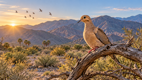
BLM records quail, sparrows, phainopeplas and other birds in the Preserve landscape. Pause at a respectful distance and let birds return to their routine. An unhurried observation often reveals more than moving closer.
Explore Mark’s bird photographsA better visit
A cool-weather morning is a useful starting point, but the forecast takes priority. Skip exposed hiking in extreme heat. Carry the water you need; do not treat oasis water as drinking water. Set a turnaround time before you start.
Soft sand can make a relatively short walk tiring. Do not assume a palm-grove outing is a paved, step-free route. Ask the manager about your specific mobility needs and the route you intend to take.
Stay on permitted trails, leave plants and rocks in place, give wildlife space and pack out everything you bring. Do not enter closed gates or cross restricted land to complete a loop shown on an app.
A different nature day
These are separate destinations, each with its own entrance, access rules and travel time. Choose one for another outing rather than assuming they connect to the Preserve’s trail system.
Morongo Valley · woodland & marsh
For a different oasis experience, explore cottonwood-and-willow habitat, birdwatching and a boardwalk. It contrasts beautifully with the fan palms and open sand here.
National park · boulders & desert transitions
Make a separate day of the park’s rock landscapes and desert habitats. Choose the entrance that fits your destinations and check the National Park Service’s current conditions.
Salton Sea · shoreline & birdlife
Explore shoreline landscapes through the State Recreation Area guide, or plan a bird-focused visit to the Sonny Bono refuge. These are different access points around a large body of water.
Valley trails · choose your terrain
Compare Palm Desert and La Quinta routes, or explore the East Indio Hills Badlands guide for another perspective on the valley’s eroded hills. Check each route’s own access and difficulty.
No. The oasis is one place within a larger conservation landscape. Use the map to distinguish the grove, McCallum Trail and the separate western and eastern approaches.
No. Check the access notice at the top of this guide. A separate trailhead’s availability does not grant access through a closed oasis gate or across restricted land.
For palms and close details, start with the short oasis visit. For a sense of the surrounding terrain, choose a route that reaches open desert. Photograph from the permitted path and allow time to stop without needing to hurry back.
No. It shows where mapped paths and landmarks sit in relation to one another. Select a specific route, save an appropriate navigation map and follow current signs and closures on the ground.
Visitor information checked October 20, 2026. Research-based planning guidance paired with Mark Miller’s original photography; this update is not a new field inspection or a report of today’s trail conditions.


