













Why Ladera Looks Different From Other Desert Golf Courses
Orchard rows, sandy channels and mountain views reveal a different approach to desert golf.

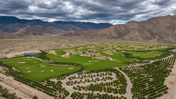
At Ladera, the orchard rows catch my eye almost as much as the fairways. Small trees repeat across pale ground, the grass curves between sandy channels, and the Santa Rosa Mountains rise behind the whole scene. My October 23 photographs show a golf landscape with a very different rhythm from the palm-lined resort courses many people associate with the Coachella Valley.
That difference began with a deliberate design choice. To understand it, look at what shapes the view—and what the architects chose to leave out.
- A different starting point: the design brief excluded palm trees and ornamental water features.
- Follow the ground: sandy channels, bunkers and fairway angles give the landscape its structure.
- Look at the setting: orchard rows and mountain slopes help explain Ladera’s distinctive appearance.
Two instructions changed the familiar picture
The starting brief was unusually simple. In Derek Duncan’s account, republished by Hanse Golf Course Design, Ladera’s founders, Irving Azoff and Eddy Cue, asked architects Gil Hanse and Jim Wagner for “no water features, no palm trees.” The project transformed a former lemon-and-mango-growing site into a course organized around sandy landforms and open views.
That choice changes where the eye goes. Instead of following tall palms or the edge of an ornamental lake, you notice the shape of the ground: a low ridge, a pale interruption in the grass, a bunker angled across the direction of play. The landscape has fewer vertical landmarks competing with the mountains.
The brief concerns the course’s design language. It is not a claim that no water exists anywhere on the property; a small body of water is visible at the edge of the wider photograph. Nor does a dry-looking design establish how much irrigation a course uses.
The orchard rows give the scene its rhythm

In my closer photograph, rows of trees spread across the foreground while a road bends between them. The repetition is almost graphic: rounded green crowns, pale ground, another row, another gap. Beyond them, the grass changes from a field of separate shapes into one continuous surface.
Those two patterns make an interesting partnership. An orchard is ordered through repetition. A golf hole is organized around a route and a destination. Here you can see both kinds of planning in the same frame.
The view also connects the club to its wider setting. Thermal’s agricultural landscape is part of the southern valley’s identity, and the planted rows help this scene read differently from a course surrounded by residential streets. Our Thermal field story explores nearby agricultural scenery from the same day’s photography.
The pale spaces are part of the design
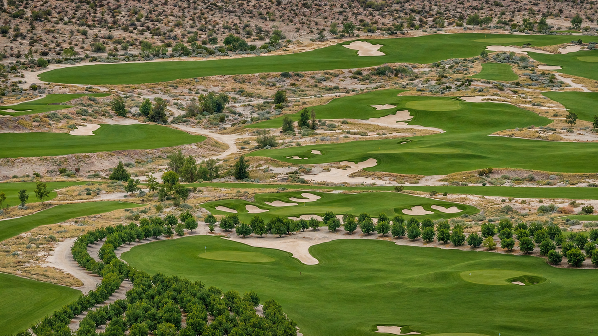
Look between the green ribbons. The light ground branches, narrows and opens out again. Some edges are sharply defined; others dissolve into scrub and scattered trees. The interruptions give the photograph depth and stop the grass from reading as one enormous lawn.
Hanse and Wagner deliberately shaped an arroyo-like landscape. Arroyo describes a dry channel; barranca, often used in golf writing about this course, describes a ravine or steep-sided channel. At Ladera, these forms are architectural ingredients, rather than proof that every depression is an untouched natural drainage.
From above, the useful distinction is between a bunker and the broader landscape around it. A pale patch can be a closely shaped sand hazard, while a larger sandy corridor connects several parts of the scene. Both affect the composition, but they need not play the same role in a golf shot.
An inviting fairway can still ask a difficult question
GOLF’s course profile emphasizes diagonal carries and the placement of bunkers and barrancas. That provides a useful way to read these aerials: follow the green route, then look at what sits across it or beside its turn.
Imagine a fairway bending around a hazard. A route farther from that hazard might leave a longer or less direct next shot. A line closer to it might offer a better approach, while demanding a more precise first shot. The point is not simply to make the landing area smaller. It is to give different parts of that area different consequences.
You do not need to be a low-handicap golfer to appreciate the idea. Think of a road with several possible approaches to the same destination. The route that looks shortest is not necessarily the route you would choose every time.
These are principles for understanding course architecture. My photographs show the layout from the air; they do not establish how a particular hole played, its pin position or the conditions a golfer encountered that day.
The mountains set the scale
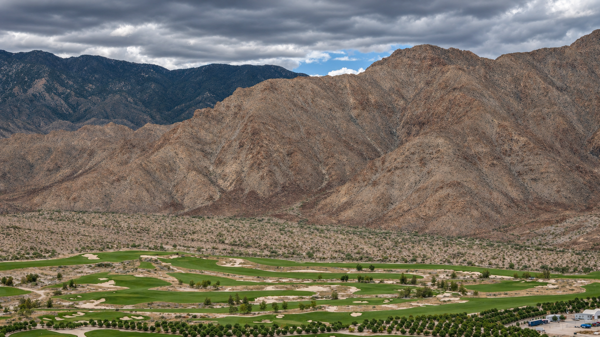
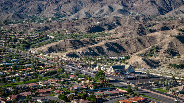
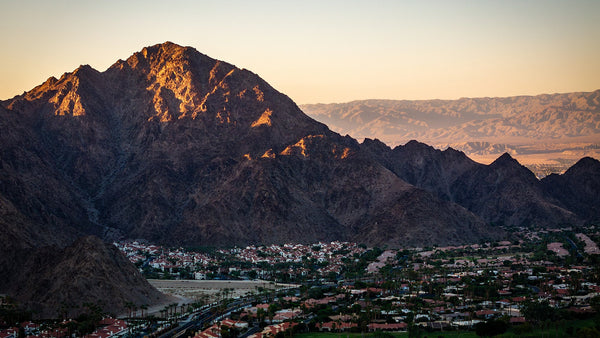
In the mountain-facing view, the course occupies a relatively narrow band at the bottom of the frame. Above it, folds and ridges fill most of the photograph. The small planted trees give your eye a scale reference; the mountain suddenly feels much larger.
That relationship is one of the most attractive things about this setting. The course is intensely designed, but the view extends into something much bigger than the playing surface. A carefully cut edge of grass and an irregular mountain ridge can share the same composition without resembling each other.
The photographs were made on a hazy, cloudy October afternoon. For this article, their exposure, color and atmospheric clarity have been enhanced with AI from my originals. The cloud cover remains part of the scene, and the original versions remain in the Ladera photo gallery.
A different way to look at desert golf
Ladera’s most useful lesson for a casual observer is a visual one. Start with the trees, then trace the grass, then follow the sandy spaces. Finally, look beyond all three to the mountains. Each layer does something different.
Ladera is a private club. For its location and the complete original photo collection, open the Ladera place guide. To explore playing options across the region, use DOI’s Golf Explorer.
Frequently asked questions
Who designed Ladera Golf Club?
Gil Hanse and Jim Wagner designed Ladera in Thermal. Hanse Golf Course Design lists its opening in 2023.
Why does Ladera look different from many desert courses?
Its design brief excluded palm trees and decorative water features. Orchard planting, sandy landforms and mountain views give it a different visual identity.
What are the sandy channels between the fairways?
The design includes shaped, arroyo-like features that contribute to the course’s appearance and strategy. Not every pale area is a bunker, and the photographs alone do not establish drainage functions.
Can anyone book a tee time at Ladera?
Ladera is private. Arrange any access through the club or an authorized host. This article is a photographic design story, not a booking service or a review of playing the course.
Were these photographs enhanced?
Yes. Mark Miller captured the original photographs on October 23, 2026, on a hazy, cloudy day. The four images used here were AI-enhanced for brightness, color and atmospheric clarity. The original seven-photo collection remains on the Ladera place page.
Sources and photo notes
Research checked November 10, 2026. Design reporting and photographic observations are distinguished in the text.
- Derek Duncan, January 10, 2024; republished by Hanse Golf Course Design January 15, 2024 — founders’ brief, former orchard site and shaped landforms.
- Hanse Golf Course Design — Original Design Projects — Thermal location and 2023 opening.
- GOLF — Ladera course profile, November 2, 2024 — private status, architects and strategic design.
Original photography © Mark Miller, October 23, 2026. Four photographs were AI-enhanced for exposure, color and clarity for this article. The images illustrate the landscape, not measured playing conditions, irrigation use or a firsthand round of golf. View the original photo collection.


