





















The Green Fields Beyond La Quinta: A Look at Thermal
Fields, farm roads and birds in the eastern Coachella Valley.

Beyond La Quinta’s neighborhoods and golf courses, the eastern Coachella Valley opens into a different kind of green: long rows, rectangular fields, farm roads and cultivated ground beneath a wide sky.
My October 23 photographs, made during an outing based in Thermal, bring that landscape into focus. From above, the fields form a pattern. Closer to the ground, a female American Kestrel sits on a wire. Overhead, turkey vultures spread their wings.
These are different views of the same broader countryside. Together, they offer a way to see the valley’s agricultural land as a working landscape that birds also use.
- Thermal opens a window onto the eastern Coachella Valley’s working agricultural landscape.
- Field patterns, bird perches and open sky reveal different parts of the scene.
- The photographs document sightings; crop identities and unseen bird behavior remain unconfirmed.
A different landscape beyond La Quinta
Thermal is southeast of Indio, in the agricultural eastern Coachella Valley. Nearby rural communities have their own names and boundaries; “Thermal” should not become a catch-all label for every field visible from the air. Riverside County describes agriculture as a defining influence on Thermal and nearby Vista Santa Rosa.
The aerial photographs here were taken on a drone flight launched from Thermal. The view extends across the surrounding countryside; it is not a map of Thermal’s boundary or a parcel-by-parcel account of its farms.
This is also a different setting from the Imperial Valley, farther south around the other end of the Salton Sea. My Imperial Valley agriculture article explores that region’s crops and irrigation. Here, the starting point is what these October photographs reveal about the eastern Coachella Valley’s landscape.
Look at the pattern before naming the crop
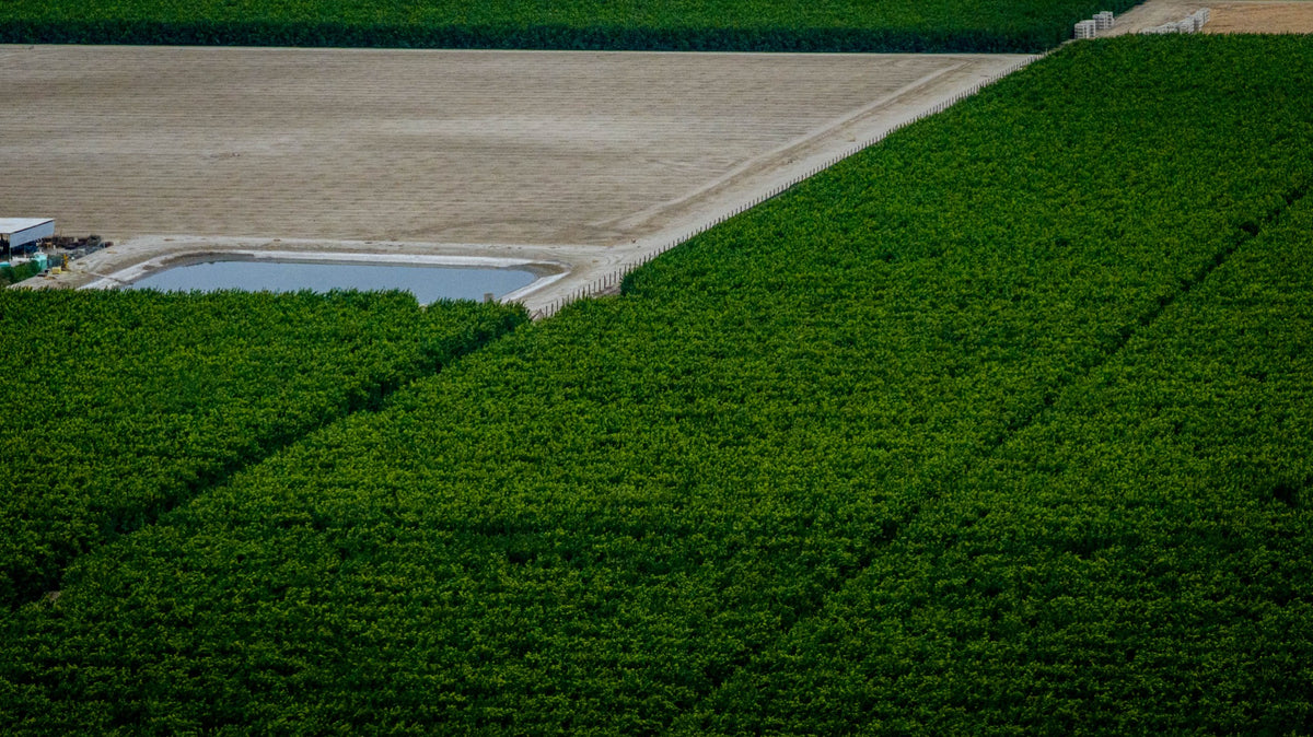
The repetition is striking. Rows run in parallel. Tracks divide one block from another. Green vegetation meets pale open ground. In the wider photograph at the top of this story, buildings and roads give the fields a sense of scale, with mountains beyond.
Those details tell us that this is organized, managed land. They do not necessarily tell us which crop is growing, when it will be harvested or who operates the farm. A pale block beside a green one may be at a different stage of use; color alone does not explain the difference.
For crop identification and regional growing seasons, start with Beyond Dates: What Grows in the Coachella Valley? This photo story asks a complementary question: what else becomes visible when we look beyond the crop itself?
The water behind the green
The contrast between cultivated green and surrounding desert has an explanation beyond the photograph. Coachella Valley Water District says agricultural irrigation in its region is supplied primarily by Colorado River water delivered through the Coachella Canal, with groundwater from privately owned wells also contributing.
That is regional context, not a verified water-source statement for each field pictured here. It helps explain why a working farm landscape belongs in a story about the desert: the vegetation depends on water management as well as climate, soil and the work of growers and farmworkers.
Our Coachella Canal history follows that larger infrastructure story. In these photographs, its significance is visible indirectly—in the presence of cultivated land where rainfall alone would not account for the scene.
A kestrel turns a wire into a vantage point
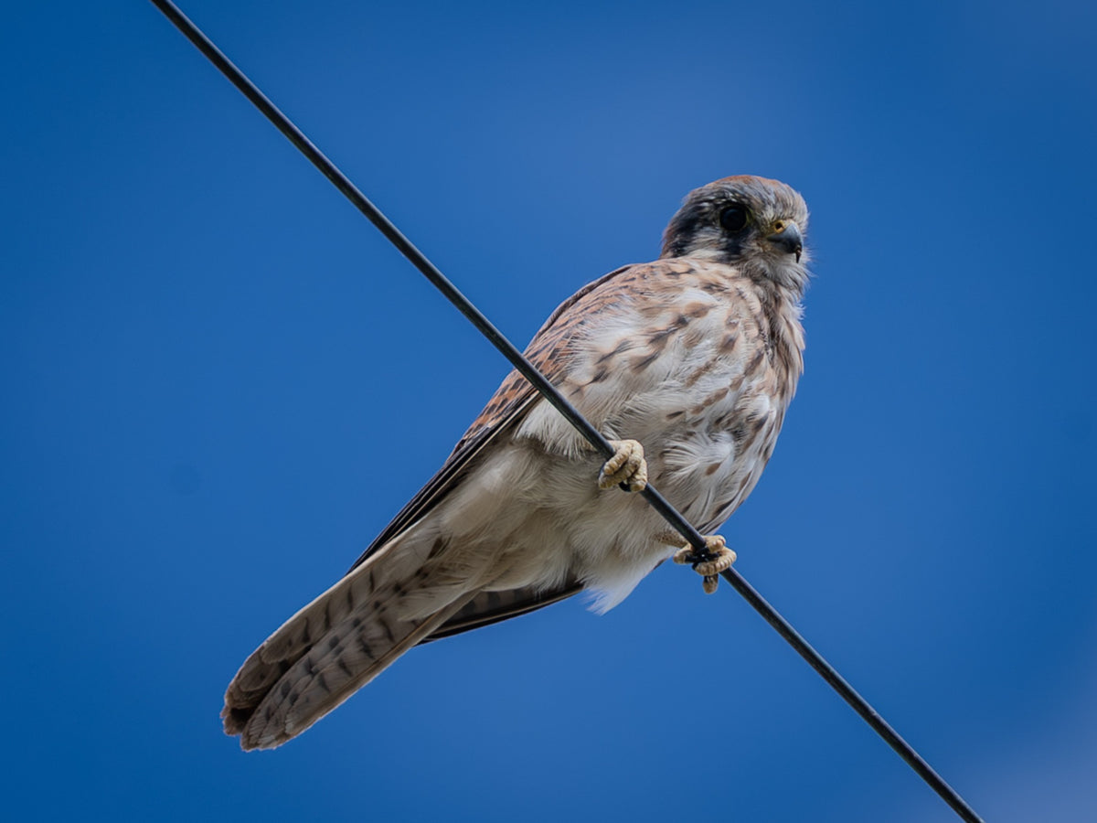
The kestrel changes the scale of the story. Instead of looking across whole fields, we are looking at one small bird gripping a wire, with its barred tail below and its head turned outward.
American Kestrels use open habitats, including farm fields, and can search for prey from elevated perches. Their diet includes insects and other invertebrates, small mammals and birds. A wire can therefore be more than a line crossing the view: it can provide a place from which a kestrel surveys the ground.
That general behavior makes the scene meaningful without telling us what this individual saw. There is no visible prey in the photograph. The useful connection is between an open landscape and a bird equipped to search it.
For the closer behavioral story, read The Tiny Falcon Above the Fields: How American Kestrels Hunt. Here, the kestrel is one reason to pay attention to the edges and structures around the fields, as well as the green within them.
Turkey vultures use a different part of the scene

The turkey vulture occupies the open sky. From below, the spread wings make the contrast between its flight feathers and darker inner wings easy to notice.
Turkey vultures range over open country, including farmland. They feed mainly on carrion and use smell to help find it. They also soar in rising warm air, which can let them gain height with relatively little flapping. A bird above a field may be searching, traveling or using lift; its position alone does not prove there is food directly underneath.
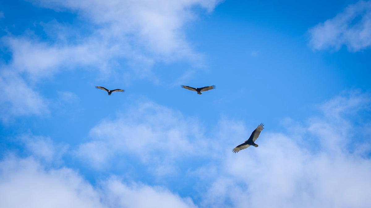
The group photograph widens the scene again. Three birds are visible against the clouds. They are part of the agricultural outing, but their movements are not confined by the straight lines that organize the ground.
Our turkey vulture field story explores their flight and feeding in more detail. The contrast with the kestrel is useful here: two birds can use the same broad countryside in very different ways.
Explore birds you may see
Choose a bird for a quick field clue, then open its DOI guide. These are possibilities around the eastern valley’s fields and open edges, not a promise for every visit.
Female illustrated
American Kestrel
- Where to look
- Wires and exposed perches beside open ground.
- Look for
- A small falcon with a long tail and two dark facial stripes. Females have warm brown wings; males have blue-gray wings.
- Watch for
- Watch for a pause on a perch, a move to another lookout or hovering. A perched bird is not proof of a hunt.
Soaring adult illustrated
Turkey Vulture
- Where to look
- Open sky above fields, roads and desert edges.
- Look for
- Long wings held in a shallow V, with paler flight feathers below. Adults have a small red head; distant head color can be hard to see.
- Watch for
- Follow the gentle rocking flight. Circling may mean gaining height in rising air, rather than feeding.
Adult illustrated
Loggerhead Shrike
- Where to look
- Fence lines, scattered shrubs and prominent perches.
- Look for
- Gray above and pale below, with a bold black eye mask, black wings and a hooked bill.
- Watch for
- Look for a still, upright lookout over open ground. Confirm the mask and bill before identifying a distant gray bird.
Adult male illustrated
Vermilion Flycatcher
- Where to look
- Low perches near open, often irrigated ground.
- Look for
- An adult male combines vivid red with dark wings and a dark eye line. Females are much subtler, with pale underparts and a peach or salmon wash.
- Watch for
- Watch for a short flight from a perch and a return after pursuing flying insects.
Speckled plumage illustrated
European Starling
- Where to look
- Ground, wires and flocks over agricultural land.
- Look for
- A chunky bird with a short tail and pointed wings. Pale speckles are conspicuous in fresh cool-season plumage; iridescence changes with the light.
- Watch for
- Notice whether birds are feeding on the ground or gathering overhead. A flock is not automatically a murmuration.
Typical adult illustrated
Red-tailed Hawk
- Where to look
- Tall poles, open fields and broad circles overhead.
- Look for
- A large, broad-winged hawk with a short, wide tail. Many adults show a rusty tail; juveniles lack it and plumage varies.
- Watch for
- Compare the broad wings with a kestrel’s pointed outline. Use several field marks rather than tail color alone.
Stylized illustrations, not to scale. Plumage varies with age, sex and season. The linked guides include photographs for a closer comparison.
Working land and wildlife overlap
It is tempting to divide a desert scene into “nature” and “development.” These photographs make that division less tidy. Cultivation, roads and utility wires shape the setting, and birds use parts of it.
That does not make farmland interchangeable with natural habitat. Different species need different food, cover and nesting places. A sighting also cannot measure the health of an entire farm ecosystem. It does show that the land between our familiar destinations deserves closer attention.
There are people behind the patterns, too. Fields are workplaces, shaped by planting, irrigation, maintenance and harvest. The birds’ presence adds another layer to that human landscape; it does not turn it into an empty place set aside for visitors.
How to look without intruding
You do not need to enter a field to begin noticing more. From a lawful public viewing place, look at three levels: the ground and field edges, the available perches, and the sky above. Watch what a bird actually does before deciding why it is there.
- Keep farm entrances, equipment access and roads clear. Stop only where parking is permitted and safe.
- Do not enter fields, orchards or irrigation facilities without permission.
- Use binoculars or a longer lens instead of approaching birds, and never use a drone to pursue them.
- Record the date and observed behavior. A useful note can be as simple as “kestrel perched on wire” or “three vultures soaring.”
For a planned public nature outing, compare the Salton Sea bird-watching guide with our Dos Palmas guide. Those are separate destinations, not access points to the farms in these photographs; check each guide’s current visiting information.
The next time the view beyond La Quinta turns green, look beyond the color. Notice the rows, the spaces between them, the wire above the road and the bird crossing the sky. There is more happening here than one wide photograph can hold.
Frequently asked questions
Are these photographs from the Coachella Valley or the Imperial Valley?
This story concerns the eastern Coachella Valley and an October 23, 2026 outing based in Thermal. The aerial photographs were made on a drone flight launched there; they are not surveyed boundaries. The Imperial Valley article covers a separate agricultural region farther south.
What crops are growing in the photographs?
The individual crops are not confirmed. Rows, color and field shape provide clues, but the article does not assign crop names to particular parcels. The linked Beyond Dates guide covers verified regional crop examples and growing seasons.
Was the kestrel hunting when it was photographed?
The photograph shows a female American Kestrel perched on a wire. Kestrels can search for prey from elevated perches, but this image does not show a capture or establish what the bird was watching.
Do circling turkey vultures mean a dead animal is directly below?
No. Turkey vultures may be searching, traveling or gaining height in rising air. A soaring bird or group does not by itself identify a feeding site.
Can I walk into these fields to photograph birds?
Not without permission from the landowner or operator. Stay in lawful public viewing areas, park safely and keep farm access clear. Use the linked public nature guides when planning a visit rather than treating photographed farms as visitor attractions.
Sources and photo notes
- Original photographs: Mark Miller, October 23, 2026. Aerial views were made on a drone flight launched from Thermal. Crop identities and individual parcel boundaries are not established by these photographs.
- Riverside County, Fourth District: District Communities — Thermal’s location and the agricultural character of nearby rural communities.
- Coachella Valley Water District: Where Does My Water Come From? — regional agricultural irrigation sources.
- Cornell Lab of Ornithology: American Kestrel Life History — habitat, food and perch-searching behavior.
- Cornell Lab of Ornithology: Turkey Vulture Life History — open-country habitat, carrion, smell and soaring behavior.
Research checked October 30, 2026. General species behavior is distinguished from behavior visible in Mark’s photographs. This is a photo essay, not a bird census, farm-access directory or assessment of an individual grower’s practices.
Bird explorer: Identification clues checked against Cornell Lab of Ornithology’s guides to Loggerhead Shrike, Vermilion Flycatcher, European Starling and Red-tailed Hawk, alongside the kestrel and vulture sources above. Illustrations are simplified editorial vectors, not measured identification diagrams. Checked October 30, 2026.


