









What Happened to Section 14 in Palm Springs?
The neighborhood, the families forced to leave, and a history still shaping the city.

Before Section 14 became a subject of lawsuits and public apologies, it was a place where families made homes. Its history belongs to the people who lived there, the Agua Caliente people whose homeland it occupied, and a city whose resort growth made the question of who could stay increasingly urgent.
To understand what happened, we have to look at more than the buildings that disappeared. We have to see the neighborhood, the restrictions surrounding it, the decisions that displaced residents, and the lives that continued afterward.
- Section 14 was a neighborhood on Agua Caliente reservation land, shaped by Tribal land restrictions and exclusion elsewhere in Palm Springs.
- Displacement occurred through several campaigns over decades, with changing roles for government agencies and land representatives.
- Published survivor accounts reveal family and community losses that maps and compensation figures cannot fully describe.
A home before it was a case
Pearl Devers remembers the closet her father built for her. He was a carpenter who had built their Section 14 home, and the small addition made his daughter feel loved and protected. In her published account, she writes: “He was so proud of our little home.”[1]
That memory is a useful place to begin. A planning map may show an allotment. An inspection may describe a structure. A child remembers the person who made a place for her clothes.
Devers also recalls moving repeatedly within Section 14 as demolition approached. Her account follows the consequences into family separation and years of pain.[1] The loss she describes reaches beyond the value of a building. It is a loss of security, familiar neighbors and the ability to stay together.
Where Section 14 is
Section 14 is roughly one square mile in central Palm Springs, generally bounded by Indian Canyon Drive, Alejo Road, Sunrise Way and Ramon Road. It is part of the Agua Caliente Indian Reservation.[12] A section number describes a land-survey unit; it does not describe a single owner or one uniform neighborhood.
The same section, different records
Read the land across two maps
The 1948 subdivision map records allotments and names. The July 2026 map records land status. Neither is a census of everyone who lived here.
November 1948 · subdivision

July 2026 · land status

The maps have different scales and purposes; compare their labels and patterns, not exact pixel positions. Land status is the map’s July 2026 snapshot. Select either map image to enlarge it.
Showing both maps.
Look first at the names. The 1948 record labels allotments and their holders. It cannot show every renter, child, business relationship or household sharing a building. Look next at the modern map: the survey section remains identifiable, while the patterns within it have changed.[11][12]
These records help locate the story. Residents’ accounts help explain what the mapped land meant to the people living on it.
Why families made their homes here
Section 14 brought together people whose positions were different. Agua Caliente landowners lived under federal restrictions on the management and leasing of their land. Tenants needed homes in a city where racial exclusion sharply narrowed their choices. Short leases, discriminatory deed covenants, lending practices and refusals to rent or sell helped shape the neighborhood.[2]
The survivors’ organization describes a community of homes, small businesses, churches and working families. Residents held jobs in hospitality, construction and domestic service, as well as running businesses of their own.[4] Their work helped sustain the resort city around them.
Housing conditions and infrastructure could be poor, but that does not make a home disposable. Nor does a short tenancy explain away the labor of making a life: fixing a room, sharing a meal, finding a job through a neighbor or helping someone through an illness.
The important question is not simply why people lived on Section 14. It is what choices the rest of Palm Springs left open to them.
Land rights and redevelopment were intertwined
Agua Caliente history cannot be reduced to the role of landlord in somebody else’s city. The Tribe’s interpretation of Section 14 emphasizes its long struggle to protect its homeland, retain its culture and recover control from outside interests. Tribal elders’ recollections were central to the museum’s Section 14 The Untold Story exhibition.[3]
Federal land management, allotments and court-appointed conservators or guardians complicated who could make decisions. The extension of lease terms to as long as 99 years in 1959 helped make larger developments financially possible.[2]
That change belongs to the history of Tribal self-determination. The displacement of tenants belongs to the same period. Understanding one requires attention to the other, without treating the Tribe, individual allottees, federal officials and conservators as interchangeable.
For a family facing removal, however, the practical question remained immediate: where could they go? Recognition of an owner’s rights did not itself produce another affordable home for a displaced tenant.
How displacement unfolded
There was no single day when Section 14 was cleared. ARG’s historical study identifies five major campaigns, with other activity between them. The sequence begins before Palm Springs incorporated in 1938.[5]
- 1936–1937: State and federal authorities led an early campaign.
- 1948–1953: County and federal action was joined by the city, which assumed leadership in 1950.
- 1954–1960: The city led another campaign with federal involvement.
- 1961–1962 and 1965–1966: City-led campaigns also involved federal officials, allottees and conservators or guardians; the Tribal Council supported the last campaign.[5]
The administrative term abatement can make this history sound bloodless. In practice, it included removing structures through demolition and burning. The study’s findings describe inconsistent procedures and cases in which tenants were not informed or buildings were removed before notice periods had elapsed.[5]
A report of a health or building-code problem is not the same thing as a record of fair treatment. To evaluate what happened, we need to ask who received notice, what happened to belongings, and whether another home was actually available.
What residents remember
Margaret’s published account describes the strain on a family already caring for a seriously ill sister. She remembers smoke, bulldozers and uncertainty about which home would be next.[6] Her testimony places the event inside an already demanding family life, rather than treating displacement as an isolated transaction.
Alvin recalls returning from school to see neighbors’ houses destroyed. His father sent him to live with a great-aunt in Las Vegas. He later became a successful musician, but describes the childhood loss as something that remained with him.[7]
These are individual memories, with distinct circumstances. They should not be flattened into one invented scene or made to stand for every resident. Together, they show why a list of demolished structures cannot measure the whole consequence.
Leaving a neighborhood may mean losing a nearby relative, a route to school, a customer, a trusted adult or the room in which a family gathers. Those connections rarely appear as separate entries in a property inventory.
Where families went, and what they carried
Betty’s account follows the story into Palm Springs’ North End. Her family sheltered people who had lost homes, sharing food, clothing and transportation. She also describes families finding shelter with relatives or moving to Banning and Indio.[8]
That is a history of displacement, but also of people helping one another. A household that took someone in became part of the response. A church could become a place to sleep. Relationships crossed city boundaries because families needed them to.
The revised study traces varied destinations and circumstances; there is no single route that every former resident followed.[2] The neighborhood’s physical disappearance did not mean its community ties instantly vanished.
Remembering those ties also changes how we read the present-day valley. Its cities have separate names on a map, while the history of a family may connect several of them.
Acknowledgment came decades later
Palm Springs formally apologized in 2021. In November 2024, the City Council approved a $5.9 million settlement for displaced residents and descendants.[9]
On October 7, 2025, the city announced that it had transferred that amount to the families’ legal representatives. The transfer is a documented milestone; it should not be described as proof that every family had received its individual payment on that date.[10]
The city also distinguished direct compensation from separately announced housing and economic-development programs. These were not simply a $27 million cash payout to former residents.[10]
Compensation and acknowledgment can matter without returning a childhood home. The work of remembering includes preserving names, accounts and records—and allowing the people affected to describe what an official resolution means to them.
Reading Palm Springs today
On your next visit to downtown Palm Springs, hold the two maps in mind. The street grid makes the section locatable. The accounts make it a neighborhood again.
The Agua Caliente Cultural Museum offers a Tribal perspective on the homeland and its history. Its specific Section 14 exhibition ran from June 2025 through May 2026; consult the museum’s current program when planning a visit.[3] The survivors’ published accounts remain another essential place to begin.
Palm Springs City Hall belongs in this story as a place of public decisions and later acknowledgment. It is separate from the former neighborhood, not a marker for the whole area.
Section 14 asks us to enlarge the familiar picture of Palm Springs. Alongside architecture, hotels and celebrated visitors, there were residents whose labor supported the city and whose ability to remain was insecure. Their history is part of understanding the place we see today.
Questions about Section 14
Where is Section 14 in Palm Springs?
It is a roughly square-mile survey section near downtown, generally between Indian Canyon Drive, Alejo Road, Sunrise Way and Ramon Road. The maps above show the area.[2]
Was Section 14 owned by the city?
No. It was reservation land with different ownership and management arrangements. The Tribe, individual allottees, federal trustees and conservators had distinct roles. A reservation boundary alone does not identify the owner of every parcel.
Was the neighborhood removed in one event?
No. The historical study identifies multiple displacement campaigns from the 1930s through the 1960s, with activity between them.[5]
Did all residents receive advance notice?
The records do not support that conclusion. The study identifies inconsistent procedures, and published survivor accounts describe people losing homes and possessions without an effective opportunity to prepare.
What did the $5.9 million settlement represent?
It was direct compensation approved for eligible former residents and descendants. The city announced its transfer to their legal representatives in October 2025. Separately announced community programs should not be confused with that cash settlement.[10]
Sources, map credits and photo notes
Reviewed October 27, 2026. The revised July 2025 study is used for context alongside published survivor accounts and Tribal interpretation. Survivor passages are attributed to their published accounts; no new interviews are implied.
- Palm Springs Section 14 Survivors: Pearl, Survivor. Published first-person account; undated.
- Architectural Resources Group, commissioned by the City of Palm Springs: Section 14 Historical Context Study, revised July 9, 2025. Especially pp. 1–2, 5–10, 17–22, 39–48, 79–119. Page numbers refer to printed report pages.
- Agua Caliente Cultural Museum: Exhibitions: Section 14 The Untold Story. Tribal interpretation; exhibition ran June 14, 2025–May 31, 2026.
- Palm Springs Section 14 Survivors: About Us. Community history and the survivors’ perspective; undated.
- Architectural Resources Group: Section 14 Historical Context Study: Key Findings. October 29, 2024; pp. 4–8 and 12–15. Read alongside the revised study.
- Palm Springs Section 14 Survivors: Margaret, Survivor. Published first-person account; undated.
- Palm Springs Section 14 Survivors: Alvin, Survivor. Published first-person account; undated.
- Palm Springs Section 14 Survivors: Betty, Survivor. Published first-person account; undated.
- Associated Press, Sophie Austin: Palm Springs officials approve $5.9M to pay Black and Latino families displaced from neighborhood. November 15, 2024; council approval and 2021 apology.
- City of Palm Springs: Section 14 Overview and dated settlement updates. Includes October 7, 2025 payment announcement and November 2024 clarification distinguishing direct compensation from other programs.
- City of Palm Springs: Section 14 Historical Slide Deck. Slide 2 reproduces the subdivision map dated November 1948. Map image extracted without redrawing its contents.
- Agua Caliente Band of Cahuilla Indians: Agua Caliente Indian Reservation Land Status, July 2026. Section 14 inset and legend; detail reproduced for comparison.
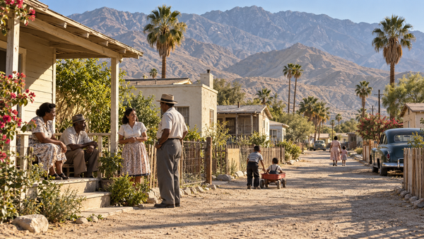
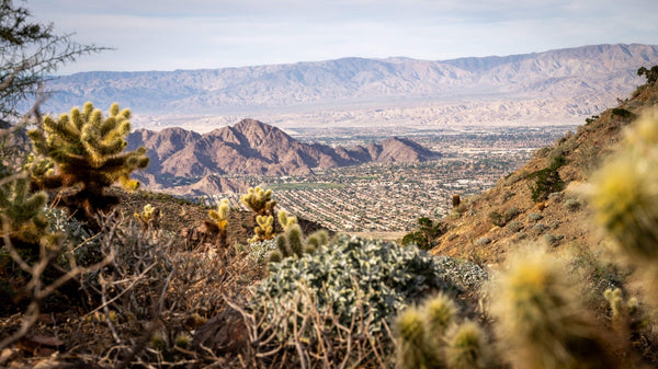
Images: The featured image is an AI-generated historical illustration of a fictional composite neighborhood inspired by midcentury Palm Springs. Its people, buildings and street do not depict identified Section 14 residents or verified addresses. It is not an archival photograph. This temporary illustration will be replaced when suitable original photography is available. The historical and current maps retain their source labels; they are not an aerial before-and-after. AI was not used to redraw the maps.


