Salton Sea History: From Lake Cahuilla to Today
How the Salton Sea evolved from ancient Lake Cahuilla to a runaway river, desert resort, ecological crisis and modern restoration effort.

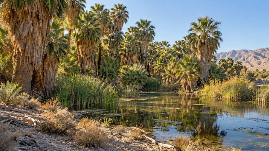
The Salton Sea has more than one beginning. Long before the modern lake formed, the Colorado River repeatedly filled this desert basin as ancient Lake Cahuilla, shaping the lives of people along its changing shores.
Follow the story from the runaway river of 1905–1907 through the resort years to today’s shrinking shoreline. The history explains how water, farming, wildlife and recreation became intertwined—and why the sea’s future is so difficult to untangle.
- Ancient basin, modern lake. Lake Cahuilla came and went long before the flood of 1905–1907.
- Water shaped human life here. Indigenous communities adapted to changing shores before farms and resorts transformed the region.
- Agriculture sustained the sea. Irrigation return flows replenished water while salts accumulated.
- The shoreline keeps changing. Today’s restoration work focuses on habitat, dust control and nearby communities.
Interactive Salton Sea Time Machine
Select an era for the turning points, then follow a link to explore the story.
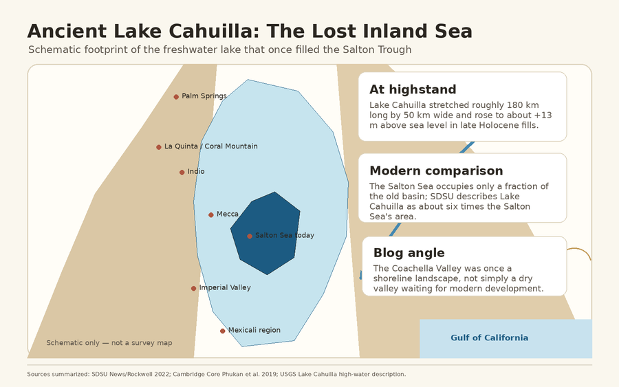
Lake Cahuilla at full highstand
The latest full freshwater highstand covered a far larger area than today’s Salton Sea. When the Colorado River shifted away, evaporation lowered the lake.
- Approximate area
- 2,200 square miles
- Surface elevation
- About 42–43 feet above sea level
The runaway river creates a modern sea
Colorado River water escaped through an uncontrolled irrigation intake, flooded the Salton Sink and resisted repeated closure attempts until February 1907.
- Land inundated
- About 330,000 acres
- Final closure
- February 10, 1907
The Desert Riviera
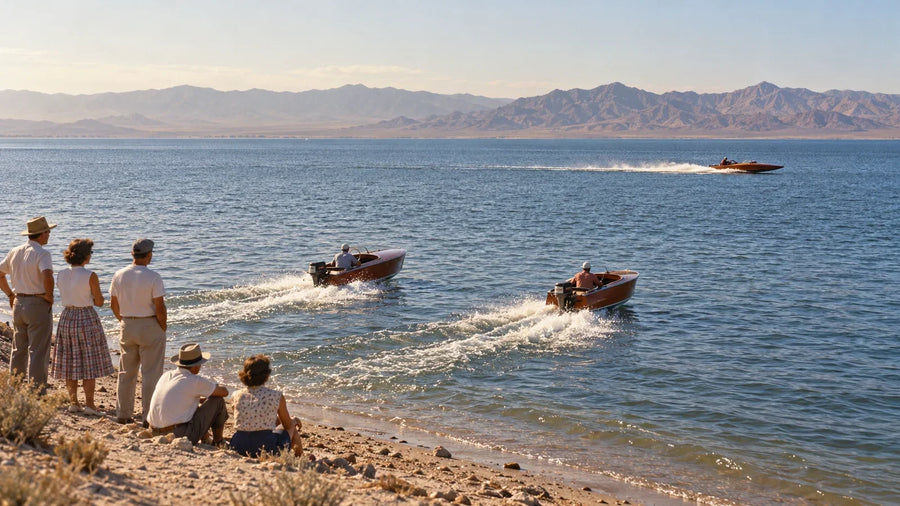
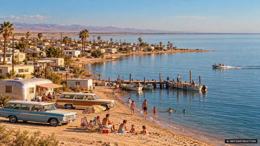
Agricultural inflow sustained a resort vision of marinas, yacht clubs and busy beaches. The sea also became an important place for migratory birds.
- State recreation area
- Established in 1955
- Shoreline life
- Marinas, beaches and yacht clubs
A water-policy turning point
The Quantification Settlement Agreement changed the sea’s water future. Mitigation deliveries slowed the initial decline, then ended in 2017.
- Agreement signed
- 2003
- Mitigation ended
- December 31, 2017
A smaller, saltier sea by 2025
Lower inflows had exposed more lakebed and concentrated salts. The changing shoreline connected habitat loss with dust concerns for nearby communities.
- Long-term change
- Less water and higher salinity
- Connected concerns
- Bird habitat and exposed lakebed
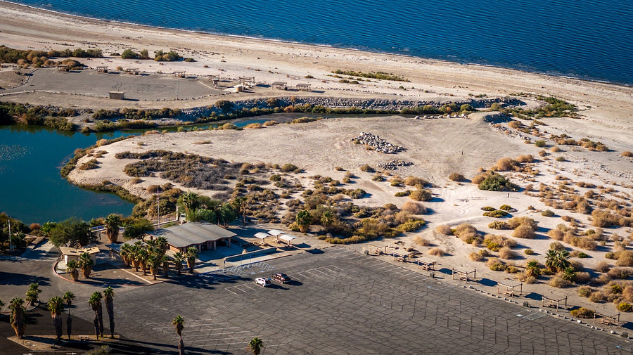
Habitat and dust-control priorities
The management program focuses on building habitat and reducing dust from exposed lakebed. These projects manage parts of a changing shoreline; they do not recreate the former resort-era sea.
- Habitat work
- Aquatic ponds and wetlands
- Dust control
- Stabilizing exposed lakebed
Conceptual illustration, not a geographic map. Shapes do not show measured shorelines, lake levels or a forecast. Historical figures are approximate; see sources below.
A quick reference
Salton Sea at a Glance
- Where is it?
- In the Salton Trough of Riverside and Imperial counties, southeast of the Coachella Valley.
- How did it form?
- Colorado River water entered the Salton Sink through an uncontrolled irrigation diversion from 1905 to 1907.
- Why did it remain?
- Agricultural drainage and river inflows offset much of the basin’s intense evaporation for decades.
- Why is it salty?
- It is a terminal lake with no outlet. Water evaporates while salts remain and accumulate.
- Why is it shrinking?
- More efficient irrigation and water transfers reduced agricultural return flows, especially after mitigation deliveries ended in 2017.
- What is restoration doing?
- Projects create habitat, control dust and protect nearby communities while agencies study longer-term alternatives.
Before the Salton Sea: A Basin Built for Water
The Salton Trough is the landward extension of the Gulf of California’s tectonic system. Faulting and subsidence created a basin whose floor lies below sea level. Meanwhile, the Colorado River carried sediment toward the gulf and built a broad delta across the trough’s southern end.
That delta acted like a shifting gate. When the river flowed south, it reached the Gulf of California. When floods and sediment redirected it northwest, water collected in the closed basin and formed Lake Cahuilla. The lake filled and receded many times over thousands of years; the modern Salton Sea occupies only its deepest remnant footprint.
A Homeland, Not an Empty Desert
The basin was never an empty stage waiting for twentieth-century development. The northern lake zone lies within Cahuilla homeland; Kumeyaay and Cocopah communities are connected to the southern basin and Colorado River delta. People adapted to repeated changes in water level, using shoreline camps, fisheries and travel routes as the lake advanced and retreated.
Hundreds of stone fish traps survive along ancient shorelines. Their changing elevations record practical responses to a moving lake. Oral histories and archaeological evidence therefore belong at the center of the Salton Sea story, not in a footnote after the 1905 flood. For the longer prehistory, read Ancient Lake Cahuilla: The Lost Sea of Coachella Valley.
1905–1907: The Runaway Colorado River
At the start of the twentieth century, promoters were building an agricultural empire in the Imperial Valley. The California Development Company diverted Colorado River water through Mexico into the old Alamo channel. When silt reduced the canal’s capacity, crews cut a new intake without adequate control gates in late 1904.
Heavy runoff in 1905 enlarged the opening. The Colorado abandoned its course to the gulf and rushed toward the Salton Sink, carrying the Alamo and New rivers with it. Water inundated roughly 330,000 acres, threatened farms and infrastructure, and created the modern Salton Sea.
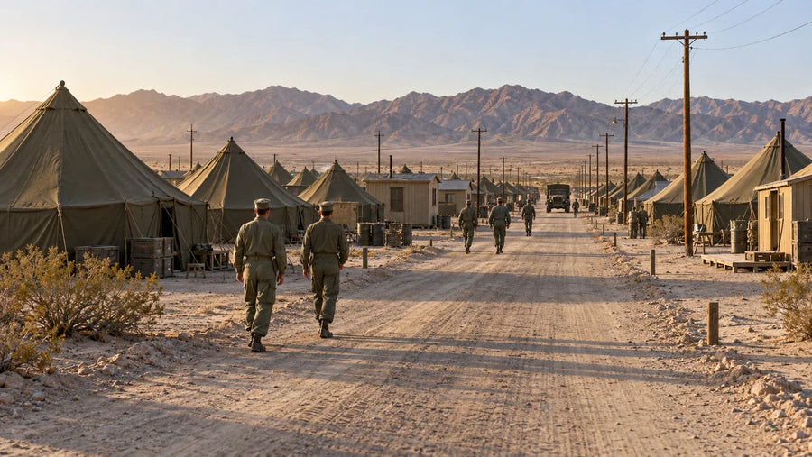
Southern Pacific crews drove piles, dumped rock and built temporary rail lines across the torrent. Early closures failed. The final breach was sealed on February 10, 1907, after an extraordinary industrial campaign. The episode was neither purely natural nor purely human: flooding supplied the force, but an inadequately controlled diversion gave the river its path.
Why the New Sea Did Not Disappear
Without new water, a lake in this hot, closed basin would shrink through evaporation. The twentieth-century Salton Sea endured because irrigated agriculture created a new water balance. Runoff from Imperial and Coachella valley farms entered the sea through the New, Alamo and Whitewater rivers, replacing much of the water lost to the atmosphere.
The arrangement also concentrated salts. Irrigation water naturally contains dissolved minerals, and evaporation removes water but leaves those minerals behind. Agricultural runoff added nutrients that increased biological productivity and sometimes contributed to algal blooms and oxygen depletion. The same inflows that sustained the sea therefore helped create long-term ecological stress.
From Wildlife Refuge to Desert Riviera
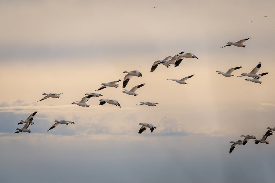
The sea became valuable wildlife habitat as California lost many other wetlands. A federal refuge was established in 1930, and the lake became an important stop on the Pacific Flyway. Pelicans, cormorants, egrets, shorebirds and vast winter flocks used its shoreline and fish-rich water.
To see how that history connects with a day outdoors, explore our Salton Sea birdwatching guide. Use the Coachella Valley bird finder to get to know individual species.
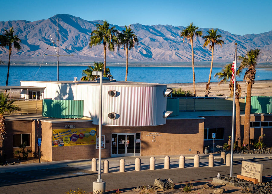
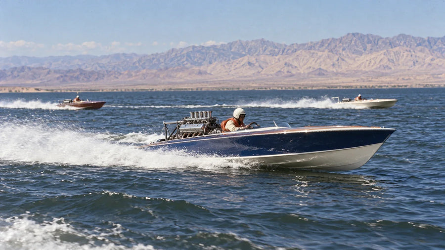
Tourism followed. California created a state recreation area in 1955. Marinas, campgrounds, yacht clubs and communities such as North Shore, Desert Shores and Bombay Beach grew around the water. The North Shore Beach and Yacht Club, speedboat races and celebrity visits helped sell the image of a desert playground.
Why the Resort Dream Unraveled
The shoreline was always difficult to control. Tropical storms in 1976 and 1977 pushed water into marinas, roads and buildings. Fluctuating levels damaged infrastructure, while increasing salinity and nutrient-rich runoff strained the ecosystem. Odors, fish die-offs and sensational coverage changed public perception even when visitors still found birds, open water and dramatic desert light.
The ecological warnings grew harder to ignore. During the 1996 botulism outbreak, crews collected more than 14,000 dead birds, including about 9,000 American White Pelicans and 1,200 Brown Pelicans. In August 1999, an estimated 7.6 million tilapia died in a single day. These events did not have one cause, but they showed how salinity, heat, disease and low-oxygen conditions could interact in a stressed terminal lake.
2003 and 2017: The Water-Policy Turning Point
The 2003 Quantification Settlement Agreement reallocated Colorado River water and encouraged agricultural conservation. Because more efficient irrigation produces less runoff, the agreement also reduced future inflow to the Salton Sea. Mitigation water was delivered for 15 years to slow the initial decline, but those deliveries ended on December 31, 2017.
That did not create every Salton Sea problem, but it accelerated a fundamental shift. As inflows fell, the shoreline receded, salinity rose and more playa became exposed. Responsibility also shifted toward building habitat and dust-suppression projects on land that had recently been underwater.
For the present-day water balance, read why the Salton Sea is shrinking and where its water goes.
A Shrinking Sea Becomes an Air-Quality Problem
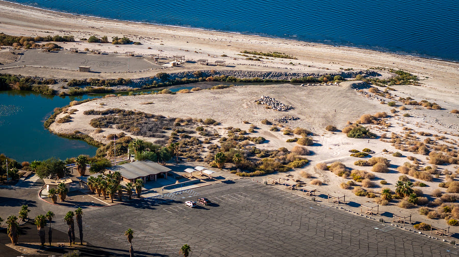
Recession exposes lakebed, or playa. When dry surfaces are disturbed and winds are strong, fine particles can become airborne. Dust risk varies with soil texture, moisture, salts, vegetation and surface crust, so not every exposed acre behaves the same way. That is why current projects use different treatments—from surface roughening and straw bales to irrigated vegetation and shallow-water habitat.
Nearby communities already experience serious air-quality burdens. Researchers continue to study how Salton Sea aerosols, agricultural emissions, regional dust and cross-border pollution interact. The careful conclusion is not that every respiratory problem comes from the sea; it is that unmanaged exposed playa can add a preventable hazard to communities already carrying too much.
What Restoration Means Today
Restoration focuses on habitat, dust control and the communities around the sea. Shallow-water habitat and treatments on exposed lakebed can address specific problems even while the larger lake continues to change. This work does not recreate the resort-era shoreline.
California’s Phase I: 10-Year Plan sets a goal of 29,800 acres of habitat and dust-suppression projects by the end of 2028. The history explains why that work became necessary; our Salton Sea restoration guide explains the approach and current projects.
Lithium Valley: A Different Story Beneath the Sea
At the southern Salton Sea, geothermal plants bring hot brine from deep underground to produce electricity. That brine contains lithium and other minerals. Direct lithium extraction aims to recover lithium from the geothermal stream before the brine is reinjected underground.
This is a different story from refilling the lake. Lithium is not being scooped from its surface water, and geothermal development does not by itself restore the Salton Sea. Environmental performance, water use, tribal consultation and community benefits all matter. Our guide to geothermal power and lithium looks more closely at how the two are connected.
Salton Sea Timeline
Open the complete chronology
- Millions of years agoTectonic extension and subsidence shape the Salton Trough; the Colorado River delta eventually separates the basin from the Gulf of California.
- Last several thousand yearsThe Colorado River repeatedly fills and abandons Lake Cahuilla.
- 1731–1733The latest full Lake Cahuilla highstand occurs.
- 1905–1907The Colorado River floods the Salton Sink; the final breach is closed on February 10, 1907.
- 1924–1928Federal orders reserve more than 123,000 acres of the sea for agricultural and subsurface drainage.
- 1930A federal wildlife refuge is established.
- 1950s–1960sThe state recreation area and North Shore Beach and Yacht Club mark the rise of the resort era.
- 1976–1977Tropical storms and high water damage shoreline communities and recreation infrastructure.
- 1996–1999Major bird and fish mortality events reveal severe ecological stress.
- 2003The Quantification Settlement Agreement changes regional water use and future inflows.
- 2017Fifteen years of mitigation water deliveries end.
- 2018–2028California’s Phase I plan targets 29,800 acres of habitat and dust suppression.
Common Myths About the Salton Sea
“The Salton Sea was always here.”
The basin held repeated ancient lakes, but the present lake dates to the Colorado River diversion failure of 1905–1907.
“It was created by one flood.”
The uncontrolled river flowed into the sink for nearly two years, not during a single storm.
“Pollution alone made it salty.”
The sea has no outlet. Evaporation naturally concentrates salts, while agricultural runoff adds nutrients and other contaminants.
“Lithium will save the sea.”
Lithium development could reshape the regional economy, but it does not replace habitat, dust control or long-term water management.
Explore the places behind the story
Start with our Salton Sea day-trip routes, then choose the places that match your interests: the North Shore Beach and Yacht Club for architecture, Salton Sea State Recreation Area for shoreline recreation, and Sonny Bono Salton Sea National Wildlife Refuge for birdwatching. These are separate destinations around the sea; check each guide for access and allow time between stops.
One name needs a distinction: ancient Lake Cahuilla was the vast lake that once filled this basin. Lake Cahuilla Veterans Regional Park in La Quinta surrounds a modern reservoir; it is not a surviving part of that ancient lake.
Frequently Asked Questions
Is the Salton Sea natural or man-made?
Both forces were involved. The basin naturally held Lake Cahuilla many times, but the modern Salton Sea formed when the Colorado River entered an inadequately controlled irrigation diversion from 1905 to 1907.
Why is the Salton Sea shrinking?
Its principal inflow has long been agricultural drainage. Irrigation efficiency and water transfers reduced that runoff, and a 15-year period of mitigation deliveries ended in 2017. Evaporation now exceeds incoming water by a wider margin.
Why does the Salton Sea smell?
Occasional odors often result when wind and seasonal mixing bring hydrogen sulfide produced in oxygen-poor deep water to the surface. Fish and algal decomposition can also contribute locally.
Can the Salton Sea be restored?
It can be managed and improved, but current plans do not attempt to refill the entire resort-era sea. Projects focus on habitat, dust suppression, community protection and evaluation of longer-term options.
Is lithium in the Salton Sea water?
The major resource is dissolved in hot geothermal brine deep beneath the southern Salton Sea region. Proposed facilities would extract lithium from that industrial brine stream, not directly from surface lake water.
Sources and further reading
Geology and Lake Cahuilla
- U.S. Geological Survey — Salton Sea science
- Rockwell and colleagues (2022) — The late Holocene history of Lake Cahuilla
History, wildlife and water policy
- California State Parks — Salton Sea State Recreation Area
- U.S. Fish & Wildlife Service — Sonny Bono Salton Sea National Wildlife Refuge
- California State Water Resources Control Board — Salton Sea program
- U.S. Bureau of Reclamation — Salton Sea program
- Shuford, Warnock and Molina — The Avifauna of the Salton Sea: A Synthesis (1999), botulism section
Current management and energy
- Salton Sea Management Program
- Salton Sea Management Program — live progress dashboard
- U.S. Army Corps of Engineers — Salton Sea feasibility study
- California Energy Commission — Lithium Valley Vision
Historical wording and linked resources reviewed October 23, 2026. Project progress changes; consult the restoration guide and official dashboard for dated status.