Why Palm Desert Exists: The Henderson Brothers, Shadow Mountain and a New Desert City
How a magazine publisher, an aviation promoter and a country-club experiment created a city—and why its original map still shapes Palm Desert today.

Palm Desert feels as if someone drew it before anyone lived there. Curving streets climb toward the Santa Rosa Mountains. El Paseo runs parallel to Highway 111 instead of forming a courthouse square. A resort club, a publishing building and carefully controlled houses appeared before there was a city government.
That impression is correct—but incomplete. The modern city grew from a deliberate postwar real-estate venture led by the Henderson family, especially promoter Clifford Henderson and Desert Magazine editor Randall Henderson. Their 1,600-acre plan south of Highway 111 joined recreation, architecture, commerce and desert scenery into one sellable idea.
Yet Palm Desert was never simply invented on vacant sand. It occupies Cahuilla homelands, grew beside the earlier settlement of Palm Village and depended on year-round workers and families whose needs did not always match the founders’ country-club vision. The city that incorporated in 1973 was broader, more complicated and more useful than the resort subdivision first advertised in the 1940s.
- Modern Palm Desert stands within Cahuilla homelands; the Henderson development was a new layer on an already inhabited landscape.
- Palm Village existed north of Highway 111 in the 1930s, before the planned community that adopted the Palm Desert name.
- During World War II, a vehicle-repair facility associated with General George S. Patton’s desert training operations occupied land along Portola Avenue.
- In 1945 the Henderson brothers began developing roughly 1,600 acres south of Highway 111, with Tommy Tomson laying out much of the early street plan.
- The Shadow Mountain Club sold leisure; the Desert Magazine Building supplied culture, commerce and a reason for a post office. Together they made the project feel like a town.
- Early architectural controls encouraged low, modern desert design, while racial restrictions and economic exclusivity narrowed who could participate in the original vision.
- Incorporation in November 1973 gave a fast-growing community its own municipal government. Interstate 10 and later development then pulled Palm Desert’s center of gravity north.
Before Palm Desert, there was a homeland and a village
The oldest history here does not begin with a land sale. The central Coachella Valley is part of the homelands of Cahuilla people, whose communities understood the desert through water, plants, trails, seasons and elevation. The mountains south of the city were not a scenic backdrop waiting to be marketed; they belonged to a connected lived landscape. That deeper relationship is introduced in How the Cahuilla Read the Desert.
By the early twentieth century, wells, roads and agriculture were changing the valley floor. Commercial date growing was expanding to the east, a transformation traced in How Dates Built the Coachella Valley. Early maps gave the future Palm Desert area the unpromising label “Sand Hole.” In the 1930s, however, homes and lots appeared north of Highway 111 in a subdivision called Palm Village.
Palm Village matters because the standard origin story often makes the Henderson brothers appear to have created settlement from nothing. They did something substantial, but different: they assembled land across the highway, imposed a coordinated plan and marketed a new kind of desert community at a scale Palm Village had not achieved.
World War II left an opening
World War II brought military activity across the Colorado Desert. The Historical Society of Palm Desert records that a jeep and tank repair facility connected with Patton’s training operations was placed along Portola Avenue. The City’s General Plan dates an associated residential development to 1943.
When the war ended, surplus buildings and former military land became pieces of a civilian opportunity. At a November 1946 sales event, four surplus wartime shacks served as an improvised commercial center containing a fruit-and-date shop, malt stand and sales office. Behind them were paved roads, partially built houses, an artificial lake, young palms and a great deal of open ground.
Cliff Henderson stood amid renderings and described what the land could become. The Palm Desert Corporation sold approximately $200,000 in property during the following two weeks. Palm Desert began not with a city hall, but with a persuasive demonstration: a few visible improvements made the rest of the plan imaginable.
The Hendersons did not all play the same role
“The Henderson brothers” is convenient shorthand, but it hides the division of labor that made the project possible. The family combined promotion, publishing, real estate, design and capital—and those roles sometimes produced different ideas about what the community should become.
Clifford Henderson
The large-scale promoter and dealmaker. His background in aviation events and major public venues shaped the project’s theatrical salesmanship and resort ambition.
Randall Henderson
The desert writer and editor. He wanted a permanent home for Desert Magazine and argued that Palm Desert needed year-round community life beyond a private club.
Phil and Carl Henderson
Phil was Cliff’s close partner and is credited by the Historical Society with suggesting the Palm Desert name. Carl brought real-estate and sales experience.
Tommy Tomson
The Hendersons’ brother-in-law, landscape designer and planner. He laid out streets south of Highway 111 and helped shape Shadow Mountain Club and the early public image of the town.
Investors and collaborators widened the circle. Leonard Firestone invested money and effort; entertainer Edgar Bergen and silent-film star Harold Lloyd were among the backers identified by the Historical Society. Architects including Albert Frey, Walter S. White, Herbert Burns, William Pereira and Cliff May translated the sales plan into buildings.
The result was not one founder’s solitary vision. It was a family enterprise with a promoter at the front, a publisher establishing credibility, a designer organizing the ground and outside capital helping the desert promise become physical.
Two anchors made a subdivision feel like a town
Most new subdivisions begin with houses. Palm Desert’s developers paired houses with two institutions that gave buyers reasons to arrive, gather and stay.
The first was Shadow Mountain Club. Construction was underway in 1947, and its grand opening followed on December 10, 1948. The club offered a huge figure-eight swimming pool, clubhouse, polo grounds and a private lake; the broader resort promoted cottages, dining, golf, tennis and stables. It converted the climate and mountain setting into recreation—the product Palm Desert could sell immediately.
The second was the Desert Magazine Building, which opened in October 1948 on Highway 111. The 17,000-square-foot building held printing and publishing operations as well as a bookstore, gem shop, art gallery and other publications. Its heavy mail traffic helped Palm Desert secure a post office, and its gallery and shops gave early residents a cultural and commercial meeting place.
Shadow Mountain sold the vacation. Desert Magazine sold the idea that the desert itself was worth understanding. Palm Desert needed both stories to become more than another tract of land.
Interactive growth map
Watch Palm Desert’s center of gravity move
Select a period to see how a foothill resort plan became a city with several centers. The diagram is schematic and ordered north to south; it is not a parcel map.
Before the Henderson plan
A corridor beside an older landscape
Cahuilla homelands connected the valley floor with the Santa Rosa Mountains. By the 1930s Palm Village had begun north of Highway 111, but no single municipal center organized the area.
How to read it: highlighted bands show the principal focus of each stage; visible bands show areas already contributing to Palm Desert. Municipal limits, postal addresses and the wider Palm Desert community are not identical.
El Paseo was a promise before it was a shopping district
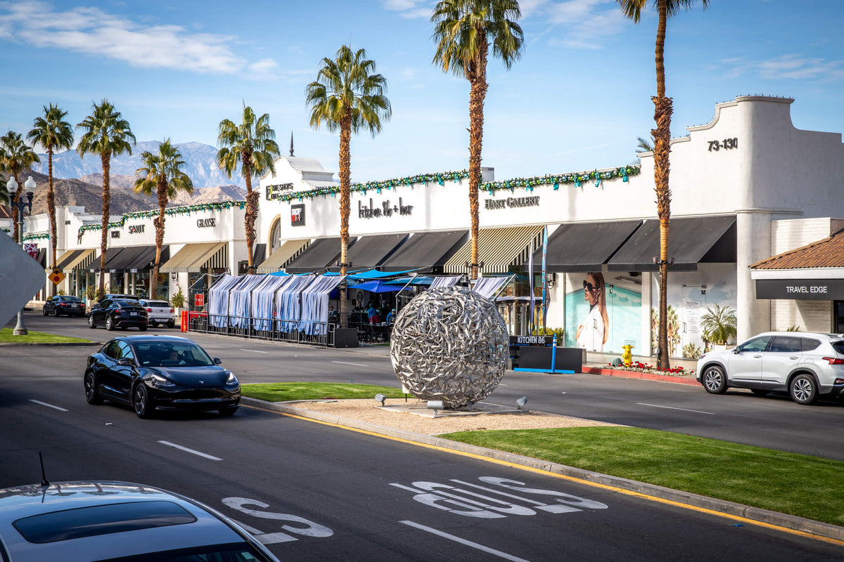
Today El Paseo can look like the inevitable commercial heart of Palm Desert. In the 1940s it was first a line in the plan—a landscaped boulevard meant to signal quality and organize the new development south of Highway 111.
A tract office stood on the boulevard by 1947, while flowers and palms began defining its medians. The street connected the highway-facing commercial zone with homes and the Shadow Mountain resort area. Stores, galleries, restaurants and luxury brands accumulated over decades. The important historical point is that El Paseo’s prestige was designed before it was fully occupied.

The surrounding streets preserve more of the original planning logic than the storefronts alone. Low rooflines, deep lots, curving roads and indoor-outdoor relationships helped establish the South Palm Desert character. The South Palm Desert guide and Randall Henderson Loop guide place that early district against the mountain landscape that inspired the project.
The plan created beauty—and exclusion
Palm Desert’s early design controls were unusually specific. Protective restrictions required one-story houses of at least 1,200 square feet, recommended a modern-ranch character and subjected plans to architectural review. Those rules helped produce the coherent low-rise streets and experimental desert modernism now celebrated as local heritage.
The same documents also imposed racial restrictions. Historical Society research reports that the 1946 covenant barred people who were not white from using or occupying property except as servants, and surviving buyer applications show that the policy was enforced. In 1948, the United States Supreme Court ruled that courts could not enforce racially restrictive covenants; the federal Fair Housing Act later prohibited housing discrimination. Those legal changes do not erase the effect of the original gatekeeping.
Economic design reinforced social separation. Large foothill parcels could include Shadow Mountain Club membership and were marketed to affluent seasonal buyers. Smaller peripheral units offered fewer improvements and more modest housing for working, year-round residents. Palm Village, where land was cheaper and less controlled, attracted many families whose labor sustained the broader community.
Why this belongs in the origin story
Architectural coherence and racial exclusion came from the same planning system. Celebrating the first while omitting the second would misrepresent how the original development worked and who had access to it.
Randall Henderson worried that his brother’s project placed too much weight on club life and too little on permanent community. He urged Cliff to build a town, not merely a prestigious seasonal enclave. Palm Desert’s later history can be read as the long process of answering that challenge.
A resort development became a year-round community
A post office opened in July 1947. The community church broke ground in 1950, a school followed in 1951, and the original fire station rose that year on land donated by Cliff Henderson. Randall and Cyria Henderson later donated land for Palm Desert’s first library, completed in 1962. By 1953, the City’s historical summary counts more than 150 homes, 14 hotels and 30 miles of roads.
Regional institutions enlarged Palm Desert’s purpose. Voters created the community-college district in 1958, and College of the Desert opened its Palm Desert campus in 1962. The Living Desert began in 1970 as another kind of civic anchor—one that treated the desert environment as something to study and conserve rather than merely decorate.

These places served students, families and residents regardless of whether they belonged to a country club. They also shifted daily life away from the original Shadow Mountain–El Paseo axis. Palm Desert was becoming a network of civic, educational, cultural and recreational destinations rather than one resort-centered subdivision.
Incorporation did not create Palm Desert
Palm Desert officially incorporated in November 1973. By then, the community had existed for more than a quarter century, and development had spread beyond the Henderson Corporation’s original acreage. Incorporation supplied a municipal government able to make local decisions about land use, streets, services and the pace and character of growth.
It also changed the meaning of “Palm Desert.” The name could describe the historic south-side plan, Palm Village and nearby neighborhoods, a postal area larger than the legal city, or the incorporated municipality itself. Those geographies still do not align perfectly. A Palm Desert city map helps separate the municipal boundary from the broader community people casually call Palm Desert.
The city adopted charter status in 1997, but its larger transformation was physical. Golf courses, condominiums, hotels and residential communities multiplied through the 1960s and 1970s. What began as the Hendersons’ attempt to sell a country-club oasis became part of a valley-wide development model. The later influence of large club developers is explored in How Sunrise Company Defined the Coachella Valley Lifestyle.
Interstate 10 pulled the city north
The historic core remained along Highway 111 and El Paseo, but completion of Interstate 10 in the 1960s changed the city’s development logic. Regional traffic, cheaper open land and new master-planned projects encouraged growth northward. Country Club Drive became an important resort and residential corridor. Later retail, employment and education clustered still farther north.
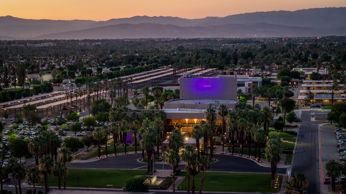
Fred Waring Drive gained a civic and cultural role through College of the Desert, City Hall, Civic Center Park and the McCallum Theatre, which opened in 1988. The university area near Cook Street added another center. Palm Desert therefore developed as several connected districts rather than a single compact downtown.

This history explains a modern planning puzzle. Palm Desert has famous streets and major institutions, yet its own General Plan still calls for a “true downtown” and a walkable university center. The city inherited strong individual destinations and automobile corridors; it did not inherit the traditional civic square that older towns grew around.
What the original plan still explains
Palm Desert exists because the Henderson enterprise made three bets at once. It bet that desert scenery could be an asset rather than a hardship. It bet that carefully controlled architecture and landscaping could convert that scenery into real-estate value. And it bet that leisure, publishing and commerce could make a remote postwar development feel culturally complete.
The bets worked, but not exactly as planned. Palm Desert needed year-round schools, fire protection, libraries, colleges, public parks and municipal government. It absorbed the lives and priorities of people who were not seasonal club members. It spread north as transportation and development economics changed. The city became larger than the founders’ acreage and more diverse than their exclusionary covenants allowed.
You can still read the layers on the ground. Begin along Highway 111 and El Paseo, then move south through Shadow Mountain and the early modernist neighborhoods. Continue north to the civic center, College of the Desert, country-club corridors and the university area. For the present-day practical version of that geography, see the Palm Desert neighborhoods and lifestyle guide.
Palm Desert was planned, but it was not finished by the plan. Its real history is the conversion of a selective resort dream into a functioning city—and the continuing effort to connect the many centers that transformation produced.
Frequently asked questions
Who founded Palm Desert?
Clifford, Randall, Phil and Carl Henderson led the planned development that adopted the Palm Desert name in the mid-1940s. Their brother-in-law Tommy Tomson laid out streets and landscapes, while investors and architects helped execute the plan. The fuller history also includes Cahuilla homelands, the earlier Palm Village settlement and the workers and families who built year-round community life.
Was Palm Desert a planned city?
Its original core was a planned private development of roughly 1,600 acres south of Highway 111. Streets, landscaping, commercial areas, a resort club and architectural controls were coordinated before municipal incorporation. The modern city later expanded far beyond that first plan.
Why is it called Palm Desert?
The Historical Society of Palm Desert credits Phil Henderson with suggesting the name. It neatly expressed the project’s marketing promise: palms, water and cultivated leisure placed within a dramatic desert landscape.
When did Palm Desert become a city?
Palm Desert incorporated in November 1973. The planned community itself dated to the mid-1940s, so incorporation formalized a place that had already accumulated homes, hotels, roads, businesses, schools and civic institutions.
Why does Palm Desert have several centers instead of one traditional downtown?
The first development focused on Highway 111, El Paseo and Shadow Mountain. Later civic and cultural institutions clustered along Fred Waring Drive, while resorts, housing, retail and universities extended north toward Interstate 10. Those successive growth corridors created a city of several destinations; current planning seeks to make them more connected and walkable.
Sources and further reading
This article uses the City’s planning history, the Historical Society of Palm Desert’s public archives and institution-specific histories. The discussion of early racial restrictions relies on the Historical Society’s review of original covenants and buyer applications.
- City of Palm Desert General Plan — official chronology, incorporation, early anchors and the city’s northward growth.
- Historical Society of Palm Desert: History of Palm Desert — Palm Village, the wartime vehicle facility and the Henderson development.
- Historical Society of Palm Desert: Founding Figures — the different roles of Cliff, Randall, Phil, Carl, Tommy Tomson and Leonard Firestone.
- Historical Society of Palm Desert: Historic Landmarks — Shadow Mountain Club, the Desert Magazine Building, fire station, library and early modernist architecture.
- Luke Leuschner, “Palm Desert: A Sellable Dream on Forsaken Land—Part II,” The Hourglass, Winter 2022 — archive-based research on the 1946 sales launch, planning restrictions, racial exclusion and the seasonal/year-round divide.
- College of the Desert: History — creation of the college district and the opening of the Palm Desert campus.
- The Living Desert Zoo and Gardens: About — the institution’s conservation mission and Palm Desert setting.
- McCallum Theatre: Mission and History — the theatre’s 1988 opening and civic-cultural role.
- U.S. Department of Housing and Urban Development: Fair Housing Act overview and U.S. Supreme Court, Shelley v. Kraemer (1948) — legal context for discriminatory housing restrictions.
- Coachella Valley Independent: How the Henderson Brothers Established Palm Desert — a secondary synthesis of the founding and incorporation chronology.
Research checked September 7, 2026. Interpretive statements about why Palm Desert developed in several centers are historical inferences drawn from the documented sequence of roads, institutions and development areas.