



















Trails & parks
Ernie Maxwell Scenic Trail
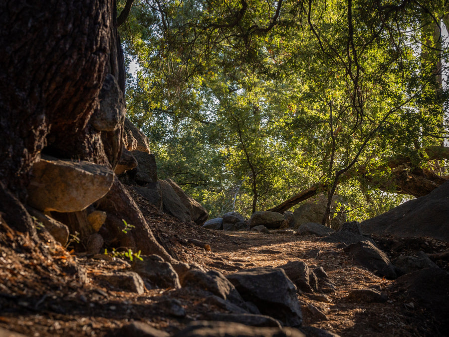
A forest trail with changing light, vegetation and granite views. Use the photographs for perspective, then check the current trail details.
Fresh from the journal
Fresh from the journal
Fresh from the journal
Fresh from the journal
Fresh from the journal
Fresh from the journal
Fresh from the journal
Fresh from the journal
Fresh from the journal
 Start hereGet to know CotinoHomes, amenities and the details that shape life in the community.
Explore next
01Explore the interactive mapFind model homes, parks, amenities and your way around. 02Visit the model homesPlan your visit and see which homes you can tour. 03Explore the floor plansCompare home collections, builders and layouts. 04Read the home buying guideUnderstand the homes, lifestyle and ownership details. 05Understand the Artisan ClubMembership, amenities and access explained. 06Visit Cotino BayThe public waterfront, beach, dining and shops. 07Follow the developmentTrack progress on homes, Cotino Bay and the Artisan Club.Natural LandmarkIdyllwild
Discover Idyllwild’s iconic granite formation, rising above the surrounding pine forest as a celebrated landmark for climbers, hikers, and photographers.
Tahquitz Rock—also known as Lily Rock—is the prominent granite formation rising above Idyllwild in Mark’s photographs. It is distinct from nearby Tahquitz Peak and the Tahquitz Peak Fire Lookout.
The U.S. Forest Service identifies Tahquitz (Lily) Rock and neighboring Suicide Rock as internationally known, multi-pitch traditional climbing crags. The formation’s steep face is technical climbing terrain, not a casual walk-up hike.
Non-climbers can appreciate Lily Rock from viewpoints around Idyllwild and along local trails. The two images here show how the formation changes from a broad mountain landmark to a dramatic granite face as the viewpoint shifts.
Checked October 6, 2026. Name and climbing context: U.S. Forest Service Palms to Pines Scenic Byway plan. Trail and landmark distinctions: U.S. Forest Service hiking guide.

Desert Oasis Insider · The San Jacinto Mountains
Put this place in context. Explore Idyllwild through its places, photographs and local stories, then use the city map to see how it all connects.
Explore the full Idyllwild collection
Tahquitz (Lily) Rock and the surrounding forest · Photography by Mark Miller
Get your bearings
Idyllwild is a mountain community with a different landscape and rhythm from the desert below. Start with the forest, the creek or the view of Tahquitz Rock. This growing visual guide connects places to explore with the wildlife and photographs that help you notice more.
The visual directory
Choose an interest, search the places and select a photograph to explore. Use Locate to see a destination on the city map.
Showing 6 of 6 places
Trails & parks
A forest trail with changing light, vegetation and granite views. Use the photographs for perspective, then check the current trail details.

Wildlife & birds
A small forest bird that rewards a closer look among the branches. Read the species profile and explore the photographs.

Trails & parks
A creek corridor that changes with rain, snowmelt and the seasons. Enjoy the photo guide and respect private land along the water.

Trails & parks
A cabin among the pines, framed by the mountain landscape. This is a photographic scene, not a bookable stay or a public destination.

Wildlife & birds
Meet a woodpecker photographed in the mountain forest and learn what to notice when watching birds from a respectful distance.
Try a shorter name or return to all guides.
Put it in perspective
Explore with DOI’s own interactive map. Choose a place to see its photograph and guide, or open the full map to explore farther.
Use two fingers to move the map on touch screens. On a computer, hold Ctrl or Command while scrolling to zoom. You can also use the zoom buttons.

A closer look at the forest
The Ernie Maxwell photo guide brings together forest textures, open views and the changing light of a mountain walk. Study the photographs, then choose an outing that fits the current conditions and your experience.
A scenic photograph does not show every condition on a trail. Use current maps and official notices, and leave the forest as you found it.
Explore Strawberry CreekMake it your own
Choose an interest for a starting plan, with links to the guides and current information you need.
Get a feel for the forest and scenery in the Ernie Maxwell guide.
Explore the trail guideUse the Forest Service for current access and requirements.
Check official forest informationLearn how the San Jacinto Mountains fit into the surrounding region.
Read the mountain guideConfirm the route and current conditions. This sequence is preparation, not a turn-by-turn trail itinerary.
Explore its profile and photographs before a forest walk.
Read the bird profileCompare the Red-breasted Sapsucker’s appearance and behavior.
Explore the sapsucker profileRead about the Pacific Flyway and the valley’s place in bird migration.
Explore the migration storyWildlife observations vary by day and season. Keep your distance and avoid disturbing birds or nests.
Study the relationship between the landmark and the forest.
Explore the rock photographsSee how water and woodland create another side of Idyllwild.
Explore Strawberry CreekExplore a cabin-and-forest composition without treating it as a visit location.
View the mountain photographThese are photographic subjects, not a continuous route. Use lawful public access and do not enter private cabin or creekside property.
Check current road information for your actual approach to Idyllwild.
Open Caltrans QuickMapCheck visitor guidance if your outing includes State Park land.
Read State Park informationExplore Palm Springs for a different kind of day when mountain conditions change.
Explore Palm SpringsConditions differ between the valley floor, town and higher trails. Recheck the official information close to departure.
The wider landscape
Regional reading on mountain geography, Cahuilla homelands and bird migration adds context to the photographs.
Mountains & regional context
Mountains & regional context
Mountains & regional context
Mountains & regional context
Make the day work
Choose one main outing, check the road and trail information, and leave time to enjoy the scenery. Keep your plan flexible when mountain weather or access changes.
Use Caltrans for current closures, restrictions and road information on your chosen route.
Open Caltrans QuickMapState Park landsReview Mount San Jacinto visitor information, permits and current notices for your outing.
Open the State Park guideNational Forest landsUse the Forest Service for its trail, access and fire-restriction information.
Open the Forest Service siteA few useful answers
Use the photographs for inspiration and the land managers for current road, trail, permit and access details.
The Tramway reaches the mountain’s high-country station above Palm Springs, not Idyllwild’s town center. Plan an Idyllwild visit as a road trip and check Caltrans for your chosen route. A line across the mountain on a map is not a road connection.
No. Tahquitz Rock, also called Lily Rock, is the prominent rock formation in this photo guide. Tahquitz Peak is a different destination. Check the exact route name and land-manager information before planning a hike or climb.
No. It shows the area and selected places for orientation. Use current trail maps, designated trailheads and the relevant land manager’s guidance to choose a route. Creek and rock pins do not identify a safe path or a public entrance.
The cabin image is a photograph, not a lodging listing or an invitation to visit private property. Bird profiles introduce species photographed in the area; wildlife moves and sightings are not guaranteed. Observe from lawful access areas and give wildlife space.
Review road conditions, the forecast, current trail access, fire restrictions and any permits for your chosen activity. Snow, ice and weather can change the outing. State Park and National Forest areas have different requirements, so confirm the rules for the actual place you plan to visit.


