















The Coachella Valley
City streets, architecture, shopping and resort life. This is the part to explore in short stages, with time to park and walk.
Fresh from the journal
Fresh from the journal
Fresh from the journal
Fresh from the journal
Fresh from the journal
Fresh from the journal
Fresh from the journal
Fresh from the journal
Fresh from the journal
 Start hereGet to know CotinoHomes, amenities and the details that shape life in the community.
Explore next
01Explore the interactive mapFind model homes, parks, amenities and your way around. 02Visit the model homesPlan your visit and see which homes you can tour. 03Explore the floor plansCompare home collections, builders and layouts. 04Read the home buying guideUnderstand the homes, lifestyle and ownership details. 05Understand the Artisan ClubMembership, amenities and access explained. 06Visit Cotino BayThe public waterfront, beach, dining and shops. 07Follow the developmentTrack progress on homes, Cotino Bay and the Artisan Club.The desert, connected
One road. Three desert worlds.
From the mountain-framed streets of the Coachella Valley to the Salton Sea and the border at Calexico, explore the places, history and everyday life connected by California’s Highway 111.
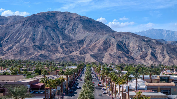
 Rancho Mirage, photographed by Mark Miller · View photograph
Start here
A desert transportation corridor—and one of the most useful ways to understand how this region fits together.
Highway 111, also called California State Route 111 or SR 111, links the Coachella Valley, the eastern side of the Salton Sea and the Imperial Valley. In everyday local conversation, “the 111” usually means the commercial boulevard connecting the desert cities: shops, restaurants, resorts, neighborhoods and mountain views.
At the regional scale, its story runs from the Interstate 10 gateway near Palm Springs to the international border at Calexico. The familiar corridor is often described as roughly 130 miles long, but that is an orientation figure, not a promise about a particular drive. Historic alignments, bypasses, city-owned segments and your chosen endpoints all affect the distance. Route sources
The local boulevard: many former state-highway sections in the Coachella Valley now belong to cities or the county. People still call them Highway 111.
The state route: California’s legal route description identifies separate state-highway sections. “Highway 111” on a business address does not automatically mean Caltrans maintains that street. Read the route distinction
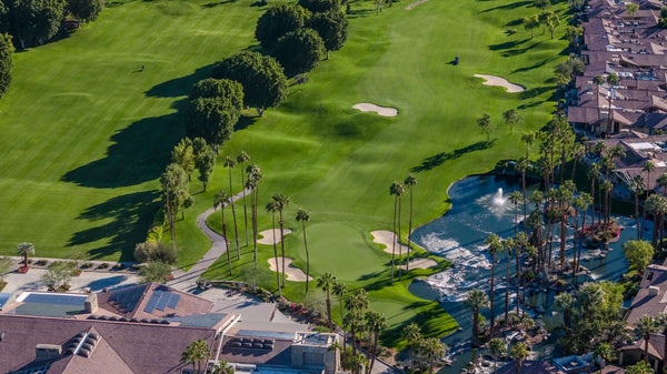
City streets, architecture, shopping and resort life. This is the part to explore in short stages, with time to park and walk.
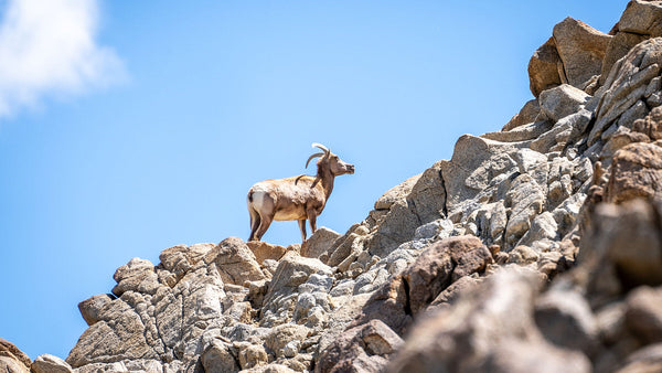
Open desert, agricultural edges and the sea’s eastern shore. The road becomes a way to read a changing landscape.
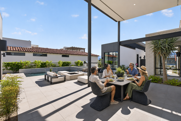
Farming communities, bird habitat and routes toward the international border. Plan each side trip and crossing separately.
Think north to south: the Palm Springs area, Cathedral City, Rancho Mirage, Palm Desert, Indian Wells, La Quinta, Indio and Coachella; then the Mecca–North Shore area, the east side of the Salton Sea, Niland, Calipatria, the Brawley area and Calexico.
That is a regional itinerary, not a list of every present-day state-maintained mile. El Centro and Holtville are nearby Imperial Valley destinations, but neither is a stop directly on today’s Highway 111 alignment. Desert Hot Springs and Thousand Palms are also outside this corridor. The route does not make a full loop around the Salton Sea.
In Palm Springs, downtown Palm Canyon Drive follows the historic/business-route experience. The signed through-route also uses Vista Chino and Gene Autry Trail. Let the destination—not just the number 111—guide your navigation.
An interactive field guide
Explore 20 cities and stops. Filter the guide, select a map marker or open a place card for a more useful next step.
Palm Springs → Calexico
The place guide below works even when the interactive map is unavailable.
Open the corridor in Google MapsLocation markers are approximate visitor orientation points, not entrances or a navigable route. Use each place’s directions before driving. Map tiles © OpenStreetMap contributors.
20 places along and near the corridor
Historic streets & architecture
Palm Canyon Drive is the historic downtown experience; signed Route 111 also uses Vista Chino and Gene Autry Trail. Choose your destination before following a route number alone.
Civic heart & cove views
The corridor meets downtown Cathedral City below the cove. Make this a separate stop for the civic center, public spaces and mountain backdrop rather than treating it as a drive-through.
Mountain edges & resort country
Watch the landscape tighten against the Santa Rosa foothills. Highway 111 connects dining and shopping areas here; the resorts and residential communities spread well beyond the boulevard.
On Highway 111 · Rancho Mirage
A convenient place to combine a meal, shops and entertainment in one stop at the Bob Hope Drive end of Rancho Mirage. Check the center’s directory for current tenants.
Side trip · Rancho Mirage
A deliberate detour north of Highway 111 on Bob Hope Drive. Plan separately for the public Center & Gardens and any ticketed historic estate tour; they are different visiting experiences.
Shopping, galleries & mountain gateway
Highway 111 is the through-corridor; El Paseo is the parallel shopping street just to its south. Highway 74 branches toward the mountains. Park once to explore the district on foot.
Side trip · Portola Avenue
Leave the boulevard for a dedicated zoo-and-gardens visit. This deserves its own time block, especially with children, rather than being squeezed between roadside stops.
Resort frontage & tennis connections
The road runs past the resort district. The Tennis Garden is a side trip near Washington Street and Miles Avenue; major tournament arrivals need their own parking and traffic plan.
Shopping corridor & old-town detour
Highway 111 serves the northern commercial corridor. Old Town, the Cove and many of the city’s best-known resort and hiking areas are south of it; allow time for the turn away from 111.
On Highway 111 · Indio
A classic date-growing stop with a shop, date shakes, a café and a garden walk. It connects the roadside experience to the agricultural story of the valley.
Date country & festival connections
The corridor becomes a useful starting point for the fairgrounds and trips into the eastern valley. Music-festival venues are not on Highway 111 itself; use the event’s assigned route and parking instructions.
A city, not just a festival name
Give Coachella its own stop for downtown, murals and the agricultural communities around it. From the city, the journey toward Mecca and the Salton Sea changes from urban boulevard to open-country travel.
Gateway to the east shore
This is the transition toward the Salton Sea. Mecca’s town center and North Shore’s waterfront are distinct stops; do not assume every point of interest sits directly on the highway.
Off Highway 111 · State Park Road
A useful first stop for shoreline context, birdwatching and photography. Check State Parks before departure for campground, visitor-center and shoreline access conditions.
Side trip · East-shore community
A lived-in community with an unusual art landscape. Use public access, respect homes and private land, and check individual venues before making a dedicated trip.
Gateway to desert side trips
Highway 111 reaches Niland before continuing toward Calipatria. Salvation Mountain and Slab City are side trips east of town, not attractions directly on 111.
Side trip · Sinclair Road
A separate destination west of Highway 111 for wetland habitat and birdwatching. Follow the refuge’s directions to its visitor center or Unit 1; these are different access points.
Agricultural valley
The southbound corridor continues through the Imperial Valley’s agricultural landscape. Allow for working roads, rail crossings and a different rhythm from the resort cities to the north.
Route 78 connections
A major junction area in the Imperial Valley. Modern through-routing and downtown streets are not interchangeable; use current navigation for your particular stop.
Border city & international gateway
The southern end of the broader Highway 111 story meets the U.S.–Mexico border. Calexico West and Calexico East are separate ports; check CBP for your crossing, lane eligibility and current waits.
No places match those filters. Try another region or a broader search.
The original reference map is retained here. Use current navigation and the official route sources for today’s road layout.

Before the boulevard
Highway 111 did not create the desert’s human story. It became a modern thread through a much older landscape.
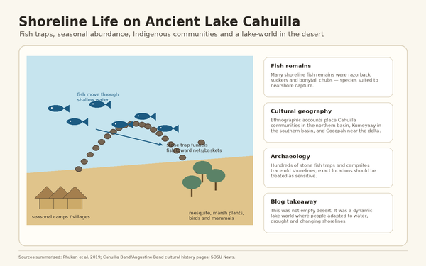
The corridor crosses ancestral Indigenous homelands, including those of Cahuilla communities in the Coachella Valley. Trade, travel, settlement and relationships with water long predate numbered highways. The Salton Sea region also holds deep connections to Kumeyaay, Quechan and Cocopah peoples. Begin with that longer view rather than imagining an empty desert waiting for a road. State Parks’ regional context
Later, rail access, irrigation, farming and automobile travel changed the pace and pattern of development. A trip along 111 still reveals those overlapping systems: resort frontage and date gardens in the north, shoreline communities in the middle, and working agricultural landscapes farther south.
Colorado River water breached an irrigation canal in 1905 and flowed into the Salton Sink. The breach was closed in 1907. Earlier Lake Cahuilla cycles belong to the basin’s longer history; the modern sea is a later chapter. CDFW background · Salton Sea Authority history
Shields Date Garden began in 1924, before the 111 number was assigned. Its continued presence helps connect today’s visitor experience to the valley’s date-growing history. Shields Date Garden
California adopted its state sign-route numbering system in 1934. The original route listing described 111 from U.S. 99 at Brawley to U.S. 60 at Whitewater, via Mecca, Indio and Palm Springs. It was not originally the exact Calexico-to-I-10 corridor familiar today. Caltrans history · 1934 route listing
As the resort cities expanded, the road’s frontage became valuable for hotels, shops and services. Palm Desert’s postwar growth is one chapter of that transformation. The result is visible today in a corridor that feels like a sequence of city boulevards. Palm Desert’s planning history
Palm Springs’ through-route was shifted away from the historic downtown alignment in 1993. Later relinquishments placed numerous Coachella Valley segments under local control. A historic route, a signed driving route and a legal state-highway definition can therefore describe different things. California Highways route history
Regional work includes CV Sync, which coordinates traffic signals across jurisdictions, including on Highway 111. The road’s future involves movement, access and how people experience the places beside it. CV Sync project
No. Parts of its story overlap former U.S. 99, particularly near the southern end, but it is misleading to describe the entire 111 corridor as a renamed U.S. 99. The numbered routes and their alignments changed over time. See the segment-by-segment history.
Make the road your own
Suggested sequences, not timed driving routes. Start near where you are staying, choose a few stops and leave room for the desert.
The city sampler
Best for: first-time visitors who want a sense of how the desert cities connect.
Leave room for: parking, walking and a stop in the shade. A cross-valley drive alone misses much of the experience.
Explore Coachella Valley stopsThe landscape day
Best for: photography, landscape context and a slower day beyond the resort cities.
Leave room for: an earlier start, water, fuel and the return drive. Check park access before departure.
Explore east-shore stopsThe southern chapter
Best for: visitors already staying in the Imperial Valley or making a longer regional journey.
Leave room for: refuge access checks and a separate plan if you intend to cross the border.
Explore Imperial Valley stops


More views from the corridor · Photographs by Mark Miller. Select a photograph to enlarge it.
Before you set out
Choose your destination first. Then check the road, the weather and the access that matters for your visit.
Highway 111 through the cities has signals, driveways and local traffic. Interstate 10 may be more useful for a longer cross-valley transfer; 111 is useful when the stops themselves are the purpose. Compare current navigation rather than relying on a fixed travel-time estimate.
Caltrans information covers state facilities. For city-owned stretches, check local street notices too. Seasonal visitor traffic and major events can change the journey substantially.
SunLine’s 1WV and 1EV routes are useful starting points for travel along the Coachella Valley corridor. Check the current map, transfers and stop notices; do not assume one bus serves the whole region or continues to the Imperial Valley.
For walking, choose a district and use marked crossings. For cycling, assess each segment and available alternatives rather than assuming a continuous protected facility along 111.
Carry water, check fuel before longer rural stretches and download the directions you need. Shade and services become less frequent beyond the city corridor. In hot weather, shorten outdoor stops and use the cooler parts of the day.
Do not drive through flooded roads or around barriers. Strong winds and dust can reduce visibility. Use designated pullouts and parking areas for photography; never stop in a travel lane to take a picture.
The Salton Sea is an evolving ecological landscape. Shoreline access, campgrounds and recreation options can change. Use current park and refuge guidance; do not infer swimming or boating access from an older photograph.
A visit to Calexico does not require crossing into Mexico. If you do cross, identify the correct port and review official entry requirements and wait information in advance.
The corridor can make everyday shopping and dining convenient, but proximity is only one part of a home search. Visit the actual property at different times, listen for road noise outdoors, check how you enter and exit the neighborhood, and drive the trips you expect to make. Compare the home’s position within its community—not just its distance from the highway.
Explore homes with Bloom Talk with Mark about the areaThe questions people actually ask
No. I-10 is the freeway used for longer regional travel. Highway 111 is a separate corridor, with local boulevard sections through the desert cities and state-highway sections farther afield. The more useful road depends on whether you are passing through or stopping along the way.
Not as a whole. Expect city boulevards with traffic signals and access points, plus rural highway and divided-road segments. Do not plan the entire journey at freeway speeds.
The familiar regional story runs between the Palm Springs/I-10 gateway and the international border at Calexico. Today’s legal state route is described in separate sections, and some well-known city stretches are no longer state-maintained. The route sources below explain that distinction.
There is no single useful time for every version of the trip. Your endpoints, alignment, traffic and stops matter. Check current navigation for driving time, then add separate time for walking, meals and attractions. A city sampler and a border-to-valley journey are very different days.
The historic/business-route experience uses Palm Canyon Drive. The signed through-route also follows Vista Chino and Gene Autry Trail, bypassing the downtown core. Enter the address of the place you actually want to visit.
El Paseo is a separate, nearby shopping street running roughly parallel to Highway 111 in Palm Desert. Leave the through-corridor, park and explore it as its own district.
No. It follows the eastern side of the sea. A full regional loop involves other roads and needs its own access, distance and time checks.
They are side trips east of Niland. Leave Highway 111 and follow destination-specific directions. Respect private and occupied areas, and check conditions before going.
No. Both belong to the wider Imperial Valley, but today’s 111 alignment runs east of El Centro and does not go through Holtville. Treat either as a separate destination.
Parts of the Coachella Valley corridor can be explored with SunLine and walking within selected districts. Review the current 1WV and 1EV routes, transfers and stop locations. Rural east-shore and Imperial Valley trips require separate transportation planning.
For outdoor stops, cooler weather and the cooler part of the day are generally easier. Summer heat changes what is comfortable and practical. Check the forecast, venue hours and daylight for your specific trip rather than treating the whole corridor as one climate-controlled outing.
No. It is a place-finding overview with approximate markers. It does not provide live traffic, entrance locations, border-lane instructions or turn-by-turn routing. Use the linked venue information and a current navigation service to drive.
Behind this guide
Editorial synthesis and photography by Mark Miller for Desert Oasis Insider. The route overview includes historic and locally maintained stretches as well as state-highway sections. Operating details and road conditions should always be checked at the source.
Have a correction or a Highway 111 story to share? Contact Mark.