



























What’s Being Built in South La Quinta? A Photo Guide
Four crossroads, four development sites, and what the city has approved at each.

At Jefferson and Avenue 52, you can see green golf fairways beside a resort site where buildings came down. A few miles south, scrapers have been moving earth below Coral Mountain. Continue toward Trilogy and two stretches of open desert raise a different question: has anyone actually been cleared to build there?
I’ve photographed all four locations. Start with the crossroads you recognize. Each stop pairs a dated view of the land with the city decision that explains it.
- Jefferson and Avenue 52 identify SilverRock. Madison and Avenue 58 identify Coral Mountain Desert Club.
- At Avenue 60, the dike and foothills help locate Travertine. Farther east, Monroe Street borders the smaller vacant parcel beside Trilogy.
- The aerials date to September 30, November 2 and November 7, 2026. Each caption records what was visible that day.
Avenue 52 and Jefferson Street · SilverRock
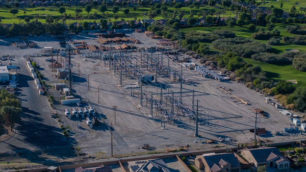
What am I looking at? Southwest of the intersection, green fairways run right up against the former Talus resort site. In my November 2 aerial, an excavator is working among broken building material. The fairways belong to the city-owned public golf course. The demolition is on the private resort parcel.

What’s been approved? La Quinta approved a revised plan with one 154-room hotel, residences and a public golf clubhouse. At the November 3 council meeting, Turnbridge reported that the previous developer’s structures had been dismantled, with slab removal and grading to follow. Turnbridge names Four Seasons as the operator and targets 2027 for vertical construction. The photograph shows why the dates matter: it was taken the day before that council update.
See the SilverRock timeline and demolition photographs.
Avenue 58 and Madison Street · Coral Mountain Desert Club
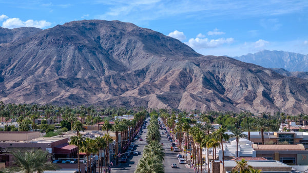
What am I looking at? At the southwest corner, use the rocky face of Coral Mountain to orient yourself. The long parallel strips at its base are easier to read from above. On November 2, I photographed scrapers moving soil along those strips. The green landscaping at the edge of the property belongs to an established neighborhood.
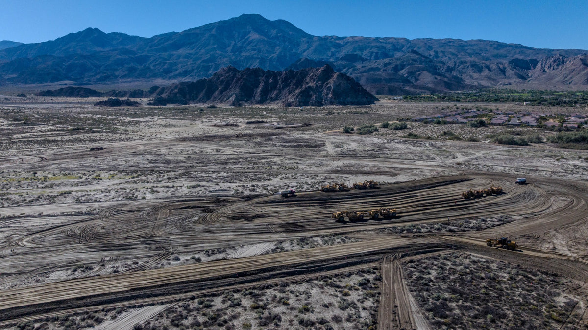
What’s been approved? The city’s plan allows an 18-hole golf course and up to 750 homes. Meriwether, the developer, describes a club with approximately 300 homesites. The larger figure is the city’s allowance. The smaller figure is what the developer is marketing. The La Quinta site is golf-centered. The surf basin associated with the club is planned separately in Thermal.
See the Coral Mountain tracker, site plan and field photographs.
Avenue 60 and Madison Street · Travertine
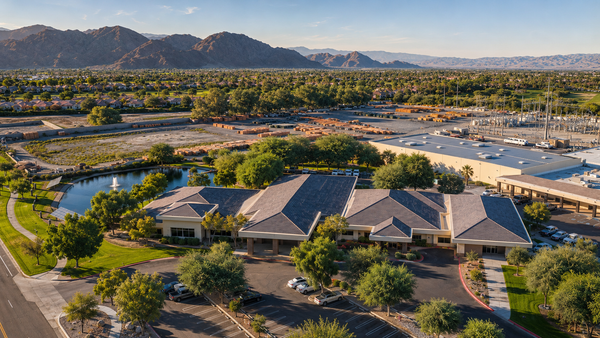
What am I looking at? Follow Madison south from Avenue 58 to Avenue 60. Here the pavement, the open foothills and the western edge of Trilogy give you a different set of landmarks. Find the raised flood-control dike in the photograph. The open land beyond it is the part of the landscape to look at when reading the Travertine plan. Madison and Avenue 60 are a reference point for the site, not a visitor entrance.
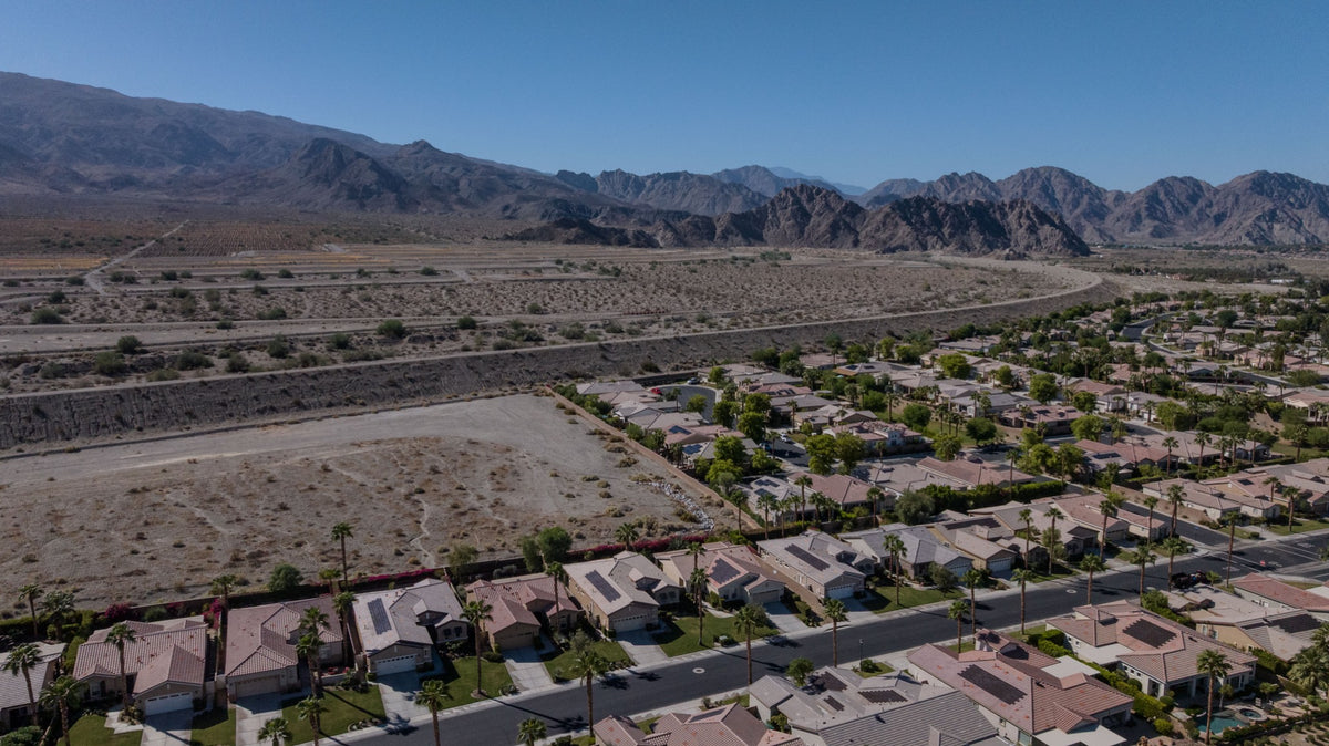
What’s been approved? The amended plan allows up to 1,200 homes, resort and recreation uses, public trails and conserved open space. The Madison alignment south of Avenue 60 is intended for emergency access. A separate planned connection at Avenue 62 helps explain why the dike matters to nearby homeowners. I haven’t verified a homebuilding start.
Open the Travertine tracker and labeled access map.
Monroe Street at Avenue 61 · The vacant lot beside Trilogy
What am I looking at? Farther east, Avenue 61 meets Monroe Street. Look west and the distinctive feature is the shape of the neighborhood: homes wrap around three sides of one open parcel. Sun Cactus Lane borders it on the north, Fire Barrel Drive on the west and Eagle Claw Drive on the south. This is the lot people ask me about when we tour Trilogy.
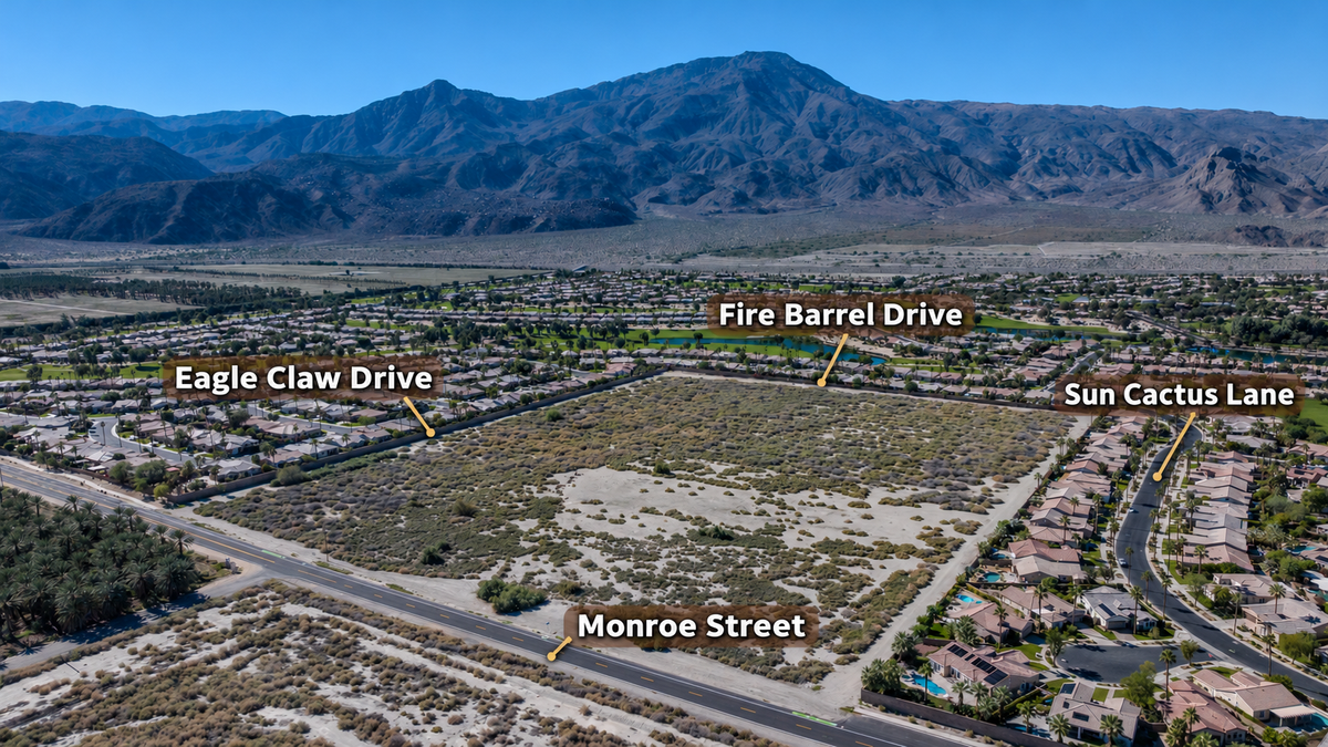
What’s been approved? In 2009, the city approved Tentative Tract Map 31434 for 94 single-family lots on about 30 acres. That vote explains the name “Monroe Ninety-Four.” The land was still open in my November 7 photographs. I haven’t verified a currently effective map, a builder or a start date. This parcel has its own planning history, separate from Travertine and from the homes already inside Trilogy.
See the four-street aerial and the original tract-map history.
South La Quinta development questions
Is SilverRock the project formerly called Talus?
Yes. Talus was the former private resort development. The current developer uses SilverRock. The adjacent city-owned public golf course has its own operation.
Is the surf basin being built at Avenue 58 and Madison?
The approved La Quinta project centers on golf and residences. The developer identifies a separate Thermal location for its surf component.
Where is Travertine relative to Trilogy La Quinta?
Look toward the foothills beyond Dike No. 4 on the western side of Trilogy. Avenue 60 and Madison Street are useful landmarks at the northern approach.
What is the vacant parcel west of Monroe at Avenue 61?
It is the roughly 30-acre site historically marketed as Monroe Ninety-Four. In 2009 the city approved a tentative map for 94 single-family lots. Its present entitlement and building schedule remain unconfirmed.
Which photographs show active work?
The November 2 SilverRock image shows demolition, and the November 2 Coral Mountain image shows grading. The Travertine and Monroe images identify open land and the neighborhoods beside it.
Sources and field photography
Planning and developer sources reviewed November 17, 2026. Field photographs by Mark Miller on the dates shown in the captions.
- City of La Quinta · SilverRock revised master plan
- City of La Quinta · November 3, 2026 council recap on demolition
- Turnbridge Equities · SilverRock operator and construction target
- City of La Quinta · Coral Mountain Club planning record
- Meriwether Companies · Coral Mountain Desert Club program
- City of La Quinta · Travertine planning record
- California CEQAnet · Travertine Specific Plan Amendment, 2024
- City of La Quinta · Resolution 2009-024, Tentative Tract Map 31434


