


























Communities
Desert Cove
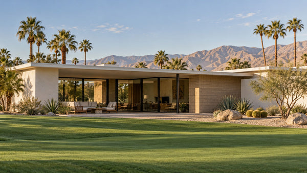
Single-story homes north of Avenue 48, near Adams Street in central La Quinta.
Residential community · access varies
Fresh from the journal
Fresh from the journal
Fresh from the journal
Fresh from the journal
Fresh from the journal
Fresh from the journal
Fresh from the journal
Fresh from the journal
Fresh from the journal
 Start hereGet to know CotinoHomes, amenities and the details that shape life in the community.
Explore next
01Explore the interactive mapFind model homes, parks, amenities and your way around. 02Visit the model homesPlan your visit and see which homes you can tour. 03Explore the floor plansCompare home collections, builders and layouts. 04Read the home buying guideUnderstand the homes, lifestyle and ownership details. 05Understand the Artisan ClubMembership, amenities and access explained. 06Visit Cotino BayThe public waterfront, beach, dining and shops. 07Follow the developmentTrack progress on homes, Cotino Bay and the Artisan Club.Golf courseLa Quinta
Explore Pete Dye’s strategic desert-links course, where rolling mounds, narrow targets, restored greens, and water hazards reward thoughtful golf.
The Dunes Course is Pete Dye’s “desert links” take—rolling mounds, thick rough, guarded greens, and water used as a true scorecard hazard. It’s also widely viewed as more player-friendly than many other PGA WEST layouts, while still demanding smart shots.
Built in 1981, the Dunes Course became part of the La Quinta/PGA WEST ecosystem and sits right by La Quinta Resort & Club, a historic resort that dates back to the 1920s.
It has legitimate competitive pedigree: the course has been tied to major qualifying and championship play, including PGA Tour Qualifying School history (notably 1998, described as the sixth time Q-School players had to tackle it).
Recent restoration: PGA WEST completed a multi-year restoration initiative across its Dye-designed courses (Stadium, Mountain, Dunes). On Dunes, the work emphasized bringing greens back toward Dye’s original intent—expanded greens, reclaimed edges/contours, and restored bunker/green “sand lines”, led by architect Tim Liddy (a longtime Dye collaborator).
“Links feel” in the desert: fescue-covered mounding and a more open look than many desert layouts, but it’s not just eye candy—those mounds and rough create awkward lies and tricky recoveries.
Shorter by modern standards, tighter by design: just over ~6,500 from the back tee, but narrow fairways and small/contoured greens keep it honest.
Water is real trouble: water comes into play on multiple holes (one write-up notes water on eight holes).
Tee shots: Prioritize position > power. Many holes reward tee balls placed on a specific side to open the safest approach into small greens.
Approaches: Distance control matters—several hole notes emphasize “don’t be long” and that greens are undulated and well-defended.
Par 5s: Many are tempting, but the real play is deciding when to attack vs. lay up to a favorite wedge yardage (Dye punishes half-committed shots).
Based on the course’s own hole descriptions:
#8 (Par 3): Water in front, right, and behind—miss left or reload.
#13 (Par 3): Short but exacting with water front/left; the course even calls out a drop area option if you splash it.
#17 (Par 4): Labeled in the course notes as the most difficult hole—long, water hugging the left side, and a two-tiered green that can turn pars into bogeys fast.
Players who want “PGA WEST flavor” without getting beat up: It’s commonly described as one of the more approachable rounds in the area—still strategic, just less brutal.
Groups with mixed skill levels: The tee spread (about 3,900–6,578 yards) makes it easy for everyone to choose a fair test.
Golfers who like design: If you enjoy thinking your way around (angles, misses, pin-high discipline), Dunes delivers.
The course is offered to resort guests and public guests (tee time booking is promoted directly through the resort page).
PGA WEST public/resort play info commonly lists Dunes among the courses welcoming public tee times.
Practice facilities: driving range, chipping/pitching, putting green, and instruction available; Dunes shares facilities with the Mountain Course and uses the Pete Dye Clubhouse.
Food/clubhouse: The Dye clubhouse is a hub (including on-site grill options), and PGA WEST’s broader revitalization included upgrades like Trackman simulators at the Pete Dye Clubhouse.
Carts: available and noted as included with green fees on common booking portals.
Dress code + spikes: collared shirt, no denim; no metal spikes.
Pick the right tee. This course gets fun when you’re hitting manageable approach clubs into those smaller, moving greens.
Aim middle on the par 3s with water. Pins are bait; pars are fine.
Never go long by default. The course literally warns you on multiple holes.
Have a “safe” par-5 plan. Decide before you swing whether it’s a 3-shot hole for you that day.
Expect better greens post-restoration. The goal was to bring back original size/shape/contours—meaning more interesting pins and more variety.
The Dunes Course in La Quinta is Pete Dye’s desert interpretation of links golf—strategic, sculpted, and quietly demanding. Rolling mounds frame manicured corridors, thick rough and well-placed bunkers reward accuracy, and water hazards add edge to several key shots. While the scorecard isn’t long by modern standards, the course earns its reputation through smart angles, disciplined approaches, and greens that ask for touch and imagination.
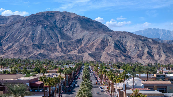
Set against the Santa Rosa Mountain backdrop and connected to the larger PGA WEST experience, Dunes is a round built for golfers who appreciate design and shot-making—challenging enough to stay memorable, playable enough to bring you back.

La Quinta, California
Put this place in context. Explore La Quinta’s neighborhoods, mountain trails, local history and everyday life, then use the city map to see how it all connects.
Explore the full La Quinta collection
Old Town La Quinta · Photography by Mark Miller
Get your bearings
La Quinta changes as you move through it: the Cove meets the desert, Old Town brings shops and gathering places together, and southern neighborhoods open onto golf courses and mountain views. Explore the photographs, place each destination on the map and find the side of the city that interests you.
The visual directory
Choose an interest, search the places and select a photograph to explore. Use Locate to see a destination on the city map.
Showing 6 of 106 places
Communities
Single-story homes north of Avenue 48, near Adams Street in central La Quinta.
Residential community · access varies

Communities
White stucco apartments and red tile roofs near Dune Palms Road and Avenue 48 in central La Quinta.
Residential community · access varies

Communities
A senior homeownership community north of Avenue 48 between Adams Street and Dune Palms Road.
Residential community · access varies

Communities
Curving residential streets, a tree-lined greenbelt and a community pool north of Avenue 48 in La Quinta.
Residential community · access varies

Explore La Quinta
The Desert Sands Unified School District’s administrative campus on Dune Palms Road in La Quinta.

Communities
Low-rise senior rental apartments beside the Miraflores greenbelt in La Quinta.
Residential community · access varies
Try a shorter name or return to all guides.
Search and filters apply to the guides on this page. Continue below for more.
Put it in perspective
Explore La Quinta with DOI’s own interactive map. Choose a place to see its guide, switch to satellite imagery, or open the full map to explore farther.
Use two fingers to move the map on touch screens. On a computer, hold Ctrl or Command while scrolling to zoom. You can also use the zoom buttons.

A different pace
The Cove trails, Lake Cahuilla and neighborhood parks offer different ways to spend time outside. Start with the setting, then choose an outing that fits the weather and your plans.
Lake Cahuilla is a regional park with its own operating rules. Trail access and recreation facilities elsewhere in La Quinta are separate.
Explore the full city mapMake it your own
Choose an interest for a starting plan, with links to the guides and current information you need.
Explore the shops, dining and architecture, then choose the places that interest you.
Explore Old TownVisit the museum’s current information and connect the modern city with its past.
Explore the museumLook at current arts programs, classes and events at Old Town Artisan Studios.
Discover the arts centerCheck opening times, current exhibitions and any class reservations before heading out.
Compare the trail options and terrain before deciding how far to go.
Read the Cove trail guideExplore Lake Cahuilla’s setting, then check official admission and activity information.
Explore Lake CahuillaDiscover Fritz Burns Park’s courts, recreation spaces and mountain backdrop.
Explore Fritz Burns ParkThese are separate options. Choose according to weather, terrain, time and current access.
Use the visual Trilogy golf guide to get familiar with its holes and mountain setting.
Open the golf course guideExplore the public golf destination and its dramatic position beneath the mountains.
Explore SilverRockLearn the resort’s history and confirm the dining or activity reservation that fits your plans.
Explore La Quinta ResortPublic, resort and private courses have different booking and access arrangements. Confirm your exact course and entrance.
Start with the La Quinta buyer guide and compare the settings of its neighborhoods.
Read the city buyer guideUse Bloom to connect available homes with the communities and locations you prefer.
Search La Quinta homesOrganize your priorities and observations before visiting properties with Mark.
Open the home-touring guideCompare the community as well as the property. Confirm the current details that affect the specific home you are considering.
Understand La Quinta through original photography: compare its areas, locate hotels and medical services, and connect the village, mountains, shopping, and freeway routes.
Read the storyA relaxed one-day itinerary from La Quinta Cove to Old Town, with brunch, local history, public art, and dinner—plus day-of-week and hot-weather alternatives.
Read the storyPlan your La Quinta Art Celebration visit: upcoming dates, tickets, parking, art, food, history, and a relaxed day in Old Town La Quinta.
Read the story Regional guide · La Quinta contextCompare 38 hikes across the Coachella Valley, Joshua Tree and the nearby San Jacinto Mountains, with an interactive trail map, parking details and shorter alternatives.
Read the story Regional guide · La Quinta contextFour places I recommend for recreational drop-in pickleball in the Coachella Valley, with honest morning-versus-night guidance, free and paid options, skill-level pods, and tips from...
Read the story Regional guide · La Quinta contextFind scenic views near Palm Springs and across the Coachella Valley without a big hike. Compare eight stops, original photographs, parking, paths and walking effort.
Read the storySeven places for an everyday walk in the Coachella Valley, from flat park circuits and zoo paths to El Paseo and downtown Palm Springs.
Read the story Regional guide · La Quinta contextFind a course that fits your game, your day and your trip. Compare 44 Coachella Valley golf profiles by location, course character, access, maintenance and...
Read the storyDiscover how Great Blue Herons combine patient watching, slow steps and sudden strikes, with Mark Miller’s Lake Cahuilla photographs and an interactive hunting guide.
Read the storyLook beyond the yellow flowers: a palo verde’s green branches help it capture sunlight when leaves are sparse. Explore the tree through Mark Miller’s La...
Read the storyFive different ways to make dinner an occasion—and a practical guide to choosing the right one.
Read the storyFind the ancient Lake Cahuilla shoreline on Coral Mountain in La Quinta. Explore Mark Miller’s annotated aerial and lower the water in an interactive diagram.
Read the storyExplore how American White Pelicans scoop, drain and swallow their food, with Mark Miller’s Lake Cahuilla photography and an interactive feeding guide.
Read the storyWhy does the Loggerhead Shrike impale prey? Explore the lookout perch, hooked bill and thorn in an interactive guide illustrated with Mark Miller’s photographs.
Read the storyLocal history
A resort, a desert neighborhood and a vanished club explain how La Quinta took shape.
Local history
Start with the resort that gave the city its name and helped establish its reputation.
Read the storyLocal history
See how an ambitious subdivision became the neighborhood below the Santa Rosa Mountains.
Read the storyLocal history
Discover the social club behind the Cove’s early promise, even though the building is gone.
Read the storyBefore golf courses and subdivisions, Point Happy was a landscape of date palms, Arabian horses, and ranch families who helped shape La Quinta.
Read the storyThe documented history of Marshall Ranch in La Quinta—from Marshall’s Cove and Hacienda del Gato to the land preserved within Tradition Golf Club.
Read the storyUnderstand Old Town La Quinta’s Main Street development, the surrounding historic Village, restaurant locations, and the difference between property owners and business operators.
Read the storyHow a parish born in borrowed spaces became a La Quinta landmark shaped by Assisi, Hollywood, local art, and more than fifty years of growth.
Read the storyA family pizza recipe, a growing franchise and two desert restaurants: follow Stuft Pizza’s story from Cerritos in 1976 to La Quinta and Palm Desert.
Read the storyFind the original La Quinta Hotel inside today’s resort using Mark Miller’s labeled aerial, casita photographs, campus film and the city’s historic survey.
Read the storyThrough Mark’s camera
Get to know the city’s neighborhoods, then come along for a scooter ride through La Quinta.
City overview and home buying
Scooter ride and local life
From visiting to living
The Cove, a golf community and a 55+ neighborhood can offer very different daily experiences. Learn the area before narrowing your search, compare homes on Bloom and plan your tours with Mark.
Compare its neighborhoods and the questions that matter before touring homes.
Read the La Quinta buyer guideCompare your optionsSee how the two cities differ in setting, communities and everyday life.
Open the city comparisonFollow what is changingSeparate the existing golf destination from the wider resort-development story.
Read the SilverRock trackerNovember 2 aerial photographs document earthwork, equipment and temporary facilities at Coral Mountain Desert Club. Follow the dated photo record, approvals and next milestones.
Read the storyHow electrical capacity, hotel and housing plans, SilverRock and public access are shaping La Quinta's next phase of growth.
Read the storyTrack Travertine in south La Quinta with verified milestones, current project status, annotated aerial views and Mark Miller’s September 30, 2026 photographs.
Read the storyMountain views, everyday drives and the quieter rhythm of life in south La Quinta.
Read the storyCompare established Capistrano homes and the later Enclave collection, with original photos, plan references, ownership questions and monthly connected MLS data.
Read the storyStudy Carmela courtyard homes, building chapters, the central green space and private outdoor living, with original photos and a monthly connected market report.
Read the storyTwo-story homes, private patios, shared amenities, and what to compare before buying in this gated south La Quinta community.
Read the storyExplore Duna La Quinta homes, HOA responsibilities and golf access with Mark Miller’s original photos and monthly MLS sales and inventory reporting.
Read the storyLarge homes, private lots, HOA amenities, and the tradeoffs between established resales and Toll Brothers’ new enclave in La Quinta.
Read the storyExplore La Quinta Country Club homes with Mark Miller’s original photos, ownership guidance and monthly MLS sales and inventory reporting.
Read the storyExplore La Quinta Cove’s distinctive homes, no-HOA lifestyle, mountain views, hiking access, Old Town proximity, and practical home-buying considerations.
Read the storyCompare La Quinta Fairways homes, courtyards, guest suites, private pools and ownership costs with seven original photos and monthly MLS sales and inventory reporting.
Read the storyCompare Lake La Quinta homes, lake and dock rights, layouts and ownership costs with original photos, video and monthly MLS sales and inventory reporting.
Read the storyExplore Mountain View Country Club homes and The Village, social and golf membership questions, ten original photos and monthly MLS sales and inventory reporting.
Read the storyUnderstand the Legends neighborhood, compare Pasadera and Ventana plan references, and separate the golf setting, ownership costs and monthly market evidence.
Read the storyExplore PGA West’s ten residential areas, compare monthly MLS data, and find neighborhood guides, original photos, maps and homes for sale.
Read the storyCompare Palm Royale condos, layouts, HOA costs, golf and rental questions with original photos and monthly MLS sales and inventory reporting.
Read the storyArchitectural homes, scenic lakes, private outdoor living, and the costs and floor plan details that shape ownership in South La Quinta.
Read the storyCompare established homes and the later Bella collection, private yards, ownership costs and South La Quinta location, with a connected monthly Market Explorer.
Read the storyExplore Puerta Azul homes, floor plans, HOA costs, amenities, rental rules, location, and recent La Quinta market data for buyers.
Read the storyCompare Rancho La Quinta homes, casitas, ownership costs and club membership with Mark Miller’s original photographs and monthly MLS sales and inventory reporting.
Read the storyStudy courtyard homes, lot positions, private outdoor space and ownership costs near Avenue 52, with original photos and a connected monthly Market Explorer.
Read the storyStudy Renaissance at La Quinta with original aerial photos, a fresh two-year MLS review, current HOA references, private-pool and home checks, rental rules and a...
Read the storyCompare The Citrus homes, guest casitas, private pools, HOA and club choices with 11 original photos and a monthly MLS market report.
Read the storyExplore the home types, private golf, renovated club facilities, and ownership choices that shape life in South La Quinta.
Read the storyA focused guide to The Palms homes, location, HOA costs, private golf membership, lot differences, and MLS resale evidence.
Read the storyExplore The Quarry’s custom homes, private golf, mountain setting, dated MLS reporting, and the details that matter when buying in South La Quinta.
Read the storyArnold Palmer golf, custom homes, mountain settings, and the membership and ownership choices that shape life in South La Quinta.
Read the storyExplore Trilogy La Quinta homes, floor plans, HOA costs, amenities, golf, location, and buying considerations. Find current pricing and detailed comparisons in the linked market-trends...
Read the storyCompare Heritage Palms and Trilogy La Quinta by home prices, HOA costs, casitas, golf, amenities and location, with interactive comparisons and live Community Explorer cards.
Read the storyCompare neighborhoods, golf, resident benefits, routes and ownership costs—with community cards and connected market prices.
Read the storyCompare wind, freeway access, neighborhoods and country-club choices—with community cards and connected market data.
Read the storyCompare Madison Club and The Hideaway by homes, golf and club lifestyle—then explore 2003–2026 MLS trends with interactive period, property-type and size controls.
Read the storyCompare Rancho La Quinta and Mountain View Country Club with MLS sales, home layouts, HOA and social costs, golf membership and buyer tradeoffs.
Read the storyCompare Trilogy La Quinta vs. Del Webb Rancho Mirage: golf, newer homes, The Outlook, HOA costs, CFD taxes, video tours, photos and closed-sale data.
Read the storyCompare Trilogy La Quinta and Sun City Palm Desert: homes, golf, community scale, HOA cost structure, daily routines and shared MLS sales evidence.
Read the storyCompare Trilogy La Quinta vs. Sun City Shadow Hills: home styles, golf, HOA costs, location, video tours, photo galleries and matching MLS sales filters.
Read the storyCompare Trilogy La Quinta and Trilogy Polo Club: 55+ rules, homes, golf, amenities, HOA and Club costs, location, market evidence, and buyer fit.
Read the storyFrom the original Drummond development to Sunrise’s continuing buildout: Andalusia’s history, home collections and six new aerial photographs from November 2, 2026.
Read the story Regional guide · La Quinta contextCompare six Coachella Valley neighborhoods through private yards, shared pools, condominium living and club connections, illustrated with Mark Miller’s photographs.
Read the storyA closer look at custom estates, villas, clubhouse suites, Tom Fazio golf, private-club living, and current dated MLS reporting.
Read the storyHow I help buyers compare homes in the same community: understanding natural light, privacy, lot position, floor-plan details, condition and the costs behind each choice.
Read the storyDiscover how Shea Homes created Trilogy La Quinta, from its original planning and infrastructure to the golf, clubs, and homes that shaped the community.
Read the storyCompare Trilogy La Quinta floor plans through office privacy, guest bathrooms, golf-cart access, courtyards and Mark Miller’s firsthand observations.
Read the storyA buyer’s guide to the one-bedroom condos on Santa Rosa Plaza, their courtyard pools, rental eligibility and recent closed sales.
Read the storyCompare two Monterey home sales in Trilogy La Quinta, one on the 14th fairway and one on a cul-de-sac, and see what came with a...
Read the storyExplore Santa Rosa Trail in South La Quinta with original aerials, a guide to detached casitas, private pools, HOA questions and the live Market Explorer.
Read the storyA few useful answers
Start with DOI’s place guides, trail information and ideas for today and this week to plan your time in La Quinta.
Old Town and the nearby museum are useful starting points for the city’s shops, culture and history. The Cove offers a different perspective at the mountain edge. Use the map to connect these areas with the resort, parks and communities farther south.
They are connected parts of the city with different roles. Old Town is a shopping, dining and gathering district. The Cove is a residential neighborhood extending toward the Santa Rosa Mountains and its trail network. Choose the destination that matches your plans.
Access differs by course. Public and resort courses use their own booking systems, while private clubs require authorized access. A home in a golf community does not automatically include golf privileges. Confirm the specific course, reservation and entrance before visiting.
Use the route or park guide to understand the terrain and access, then check current weather and official notices. Desert trails can be exposed and uneven. Lake Cahuilla has its own admission and activity rules; a map pin does not confirm that every facility is available.
Start with the neighborhood’s location, home types, amenities and day-to-day surroundings. Use the city and community guides to build perspective, explore current listings on Bloom and arrange authorized tours with Mark. Community rules, costs and club access need property-specific review.
The surrounding area

Compare La Quinta neighborhoods, layouts, association and club costs with Mark Miller’s photos, videos, city map, relocation advice and dedicated market report.

How electrical capacity, hotel and housing plans, SilverRock and public access are shaping La Quinta's next phase of growth.

Three trails begin where La Quinta Cove meets the Santa Rosa Mountains. Learn where to park, which route fits your day, when to hike...


